Castellamonte geodata
Castellamonte (Piedmont) is a seat of a third-order administrative division; located in Italy in Europe/Rome (GMT+2) time zone. With population of 7,215 people, there are 1353 cities with bigger population in this country. Compared to other cities in Italy, 69.8% of cities are located further ↓South; 96.2% of cities are located further →East and 65.5% of cities have lower elevation than Castellamonte. Note1


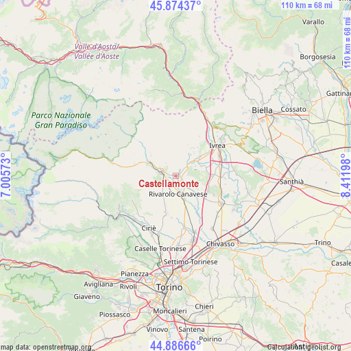
Castellamonte GPS coordinates[2]
45° 22' 57.612" North, 7° 42' 31.896" East
| Map corner | latitude | longitude |
|---|---|---|
| Upper-left | 45.87437°, | 7.00573° |
| Center: | 45.38267°, | 7.70886° |
| Lower-right: | 44.88666°, | 8.41198° |
| Map W x H: | 109.8×109.8 km | = 68.2×68.2mi |
| max Lat: | 47.04031° ⇑30.2% North |
| Castellamonte: | 45.38267° |
| min Lat: | ⇓69.8% South 35.50142° |
| min Long | Castellamonte | max Long |
| 6.69888° | 7.70886° | 18.48682° |
| W 3.8%⇐ | ⇒96.2% E |
Elevation
Elevation of Castellamonte is 348 m = 1142 ft, and this is 41.3 m = 135 ft above average elevation for this country.
| Max E: |
2085 m = 6841 ft | 34.5% |
| Castellamonte | 348 m 1142 ft | |
| Avg. | 306.7 m = 1006 ft | |
Min E: |
-4 m = -13 ft | 65.5% |
See also: Italy elevation on elevation.city.
Geographical zone
Castellamonte is located in North temperate zone (between Tropic of Cancer and the Arctic Circle). Distance of this North polar circle is 2355.1 km =1463.4 mi to North.| Distance of | km | miles | from Castellamonte |
|---|---|---|---|
| North Pole | 4961 | 3082.6 | to North |
| Arctic Circle | 2355.1 | 1463.4 | to North |
| Tropic Cancer | 2440.2 | 1516.3 | to South |
| Equator | 5046.1 | 3135.5 | to South |


Nearby cities:
15 places around Castellamonte: (largest is in red/bold)
• Agliè
4.9 km =3 mi,  109°
109°
• Bairo
3.6 km =2.2 mi,  84°
84°
• Baldissero Canavese
4.1 km =2.5 mi,  41°
41°
• Borgiallo
4.9 km =3 mi,  321°
321°
• Chiesanuova
5.7 km =3.5 mi,  312°
312°
• Cintano
5.3 km =3.3 mi,  342°
342°
• Colleretto Castelnuovo
5 km =3.1 mi,  332°
332°
• Cuorgnè
4.7 km =2.9 mi,  284°
284°
• Favria
6 km =3.7 mi,  195°
195°
• Oglianico
4.8 km =3 mi, 196°
• Ozegna
4.8 km =3 mi,  143°
143°
• Salassa
3.1 km =1.9 mi,  221°
221°
• San Ponso
4.6 km =2.9 mi, 219°
• Torre Canavese
4.1 km =2.5 mi, 75°
• Valperga
4 km =2.5 mi,  249°
249°
Sources, notices
• [Note1] Compared only with cities in Italy existing in our database
• [Src1] Map data: © OpenStreetMap contributors (CC-BY-SA)
• [Src2] Other city data from geonames.org with taken over terms of usage.
• [Src3] Geographical zone / Annual Mean Temperature by Robert A. Rohde @ Wikipedia
