Campodimele geodata
Campodimele (Latium) is a populated place; located in Italy in Europe/Rome (GMT+2) time zone. With population of 693 people, there are 8345 cities with bigger population in this country. Compared to other cities in Italy, 75.6% of cities are located further ↑North; 68.6% of cities are located further ←West and 89.6% of cities have higher elevation than Campodimele. Note1


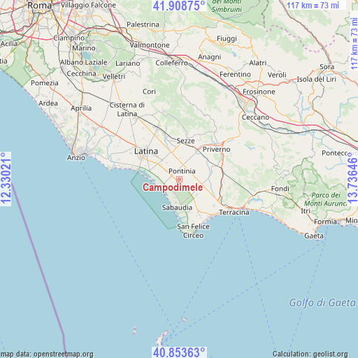
Campodimele GPS coordinates[2]
41° 22' 59.988" North, 13° 1' 59.988" East
| Map corner | latitude | longitude |
|---|---|---|
| Upper-left | 41.90875°, | 12.33021° |
| Center: | 41.38333°, | 13.03333° |
| Lower-right: | 40.85363°, | 13.73646° |
| Map W x H: | 117.3×117.3 km | = 72.9×72.9mi |
| max Lat: | 47.04031° ⇑75.6% North |
| Campodimele: | 41.38333° |
| min Lat: | ⇓24.4% South 35.50142° |
| min Long | Campodimele | max Long |
| 6.69888° | 13.03333° | 18.48682° |
| W 68.6%⇐ | ⇒31.4% E |
Elevation
Elevation of Campodimele is 19 m = 62 ft, and this is 287.7 m = 944 ft below average elevation for this country.
| Max E: |
2085 m = 6841 ft | 89.6% |
| Avg. | 306.7 m = 1006 ft | |
| Campodimele | 19 m = 62 ft | |
Min E: |
-4 m = -13 ft | 10.4% |
See also: Italy elevation on elevation.city.
Geographical zone
Campodimele is located in North temperate zone (between Tropic of Cancer and the Arctic Circle). Distance of this Northern Tropic circle is 1995.5 km =1239.9 mi to South.| Distance of | km | miles | from Campodimele |
|---|---|---|---|
| North Pole | 5405.7 | 3358.9 | to North |
| Arctic Circle | 2799.8 | 1739.7 | to North |
| Tropic Cancer | 1995.5 | 1239.9 | to South |
| Equator | 4601.4 | 2859.2 | to South |


Nearby cities:
15 places around Campodimele: (largest is in red/bold)
• Bella Farnia
5.1 km =3.2 mi,  250°
250°
• Borgo Faiti
9.7 km =6 mi,  343°
343°
• Borgo Grappa
6.4 km =4 mi,  288°
288°
• Borgo San Michele
7.9 km =4.9 mi,  320°
320°
• Borgo Vodice
7.6 km =4.7 mi,  129°
129°
• La Fiora
14.5 km =9 mi,  112°
112°
• Latina
14.2 km =8.8 mi,  310°
310°
• Molella
13.9 km =8.6 mi,  170°
170°
• Pontinia
3.2 km =2 mi,  14°
14°
• Prato di Coppola
13.2 km =8.2 mi, 286°
• Sabaudia
9.2 km =5.7 mi,  182°
182°
• San Donato
3 km =1.9 mi, 286°
• Scopeto Madonna Gulia
7.4 km =4.6 mi, 307°
• Sezze
13.2 km =8.2 mi, 10°
• Sezze Scalo
12.7 km =7.9 mi,  3°
3°
Sources, notices
• [Note1] Compared only with cities in Italy existing in our database
• [Src1] Map data: © OpenStreetMap contributors (CC-BY-SA)
• [Src2] Other city data from geonames.org with taken over terms of usage.
• [Src3] Geographical zone / Annual Mean Temperature by Robert A. Rohde @ Wikipedia
