Camogli geodata
Camogli (Liguria) is a seat of a third-order administrative division; located in Italy in Europe/Rome (GMT+2) time zone. With population of 4,934 people, there are 1975 cities with bigger population in this country. Compared to other cities in Italy, 51.2% of cities are located further ↑North; 78.8% of cities are located further →East and 83.7% of cities have higher elevation than Camogli. Note1


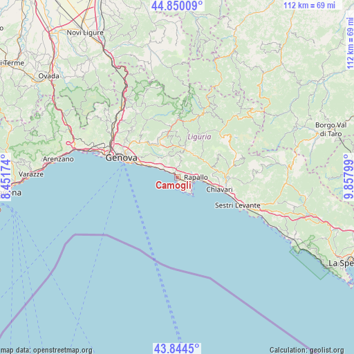
Camogli GPS coordinates[2]
44° 20' 58.02" North, 9° 9' 17.532" East
| Map corner | latitude | longitude |
|---|---|---|
| Upper-left | 44.85009°, | 8.45174° |
| Center: | 44.34945°, | 9.15487° |
| Lower-right: | 43.8445°, | 9.85799° |
| Map W x H: | 111.8×111.8 km | = 69.5×69.5mi |
| max Lat: | 47.04031° ⇑51.2% North |
| Camogli: | 44.34945° |
| min Lat: | ⇓48.8% South 35.50142° |
| min Long | Camogli | max Long |
| 6.69888° | 9.15487° | 18.48682° |
| W 21.2%⇐ | ⇒78.8% E |
Elevation
Elevation of Camogli is 35 m = 115 ft, and this is 271.7 m = 891 ft below average elevation for this country.
| Max E: |
2085 m = 6841 ft | 83.7% |
| Avg. | 306.7 m = 1006 ft | |
| Camogli | 35 m = 115 ft | |
Min E: |
-4 m = -13 ft | 16.3% |
See also: Italy elevation on elevation.city.
Geographical zone
Camogli is located in North temperate zone (between Tropic of Cancer and the Arctic Circle). Distance of this Northern Tropic circle is 2325.3 km =1444.9 mi to South.| Distance of | km | miles | from Camogli |
|---|---|---|---|
| North Pole | 5075.9 | 3154 | to North |
| Arctic Circle | 2470 | 1534.8 | to North |
| Tropic Cancer | 2325.3 | 1444.9 | to South |
| Equator | 4931.2 | 3064.1 | to South |


Nearby cities:
15 places around Camogli: (largest is in red/bold)
• Avegno
3.7 km =2.3 mi,  3°
3°
• Avegno Chiesa
4.3 km =2.7 mi,  9°
9°
• Bogliasco
7.6 km =4.7 mi,  297°
297°
• Ferrada
9 km =5.6 mi,  29°
29°
• Moconesi
9 km =5.6 mi, 28°
• Pieve Ligure
5.6 km =3.5 mi, 300°
• Poggio Favaro-San Bernardo
7.1 km =4.4 mi, 301°
• Portofino
6.7 km =4.2 mi,  139°
139°
• Rapallo
5.8 km =3.6 mi,  89°
89°
• Recco
1.7 km =1.1 mi,  327°
327°
• Santa Margherita Ligure
4.8 km =3 mi,  110°
110°
• Sori
4.8 km =3 mi, 303°
• Testana
5.2 km =3.2 mi,  352°
352°
• Tribogna
8.1 km =5 mi,  23°
23°
• Uscio
7 km =4.3 mi, 4°
Sources, notices
• [Note1] Compared only with cities in Italy existing in our database
• [Src1] Map data: © OpenStreetMap contributors (CC-BY-SA)
• [Src2] Other city data from geonames.org with taken over terms of usage.
• [Src3] Geographical zone / Annual Mean Temperature by Robert A. Rohde @ Wikipedia
