Besano geodata
Besano (Lombardy) is a seat of a third-order administrative division; located in Italy in Europe/Rome (GMT+2) time zone. With population of 2,594 people, there are 3421 cities with bigger population in this country. Compared to other cities in Italy, 88.8% of cities are located further ↓South; 82.9% of cities are located further →East and 65.5% of cities have lower elevation than Besano. Note1


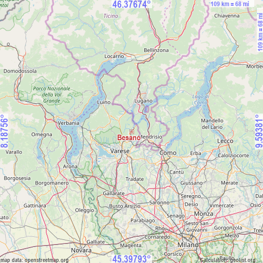
Besano GPS coordinates[2]
45° 53' 22.164" North, 8° 53' 26.448" East
| Map corner | latitude | longitude |
|---|---|---|
| Upper-left | 46.37674°, | 8.18756° |
| Center: | 45.88949°, | 8.89068° |
| Lower-right: | 45.39793°, | 9.59381° |
| Map W x H: | 108.8×108.8 km | = 67.6×67.6mi |
| max Lat: | 47.04031° ⇑11.2% North |
| Besano: | 45.88949° |
| min Lat: | ⇓88.8% South 35.50142° |
| min Long | Besano | max Long |
| 6.69888° | 8.89068° | 18.48682° |
| W 17.1%⇐ | ⇒82.9% E |
Elevation
Elevation of Besano is 348 m = 1142 ft, and this is 41.3 m = 135 ft above average elevation for this country.
| Max E: |
2085 m = 6841 ft | 34.5% |
| Besano | 348 m 1142 ft | |
| Avg. | 306.7 m = 1006 ft | |
Min E: |
-4 m = -13 ft | 65.5% |
See also: Italy elevation on elevation.city.
Geographical zone
Besano is located in North temperate zone (between Tropic of Cancer and the Arctic Circle). Distance of this North polar circle is 2298.7 km =1428.3 mi to North.| Distance of | km | miles | from Besano |
|---|---|---|---|
| North Pole | 4904.6 | 3047.6 | to North |
| Arctic Circle | 2298.7 | 1428.3 | to North |
| Tropic Cancer | 2496.5 | 1551.3 | to South |
| Equator | 5102.4 | 3170.5 | to South |


Nearby cities:
15 places around Besano: (largest is in red/bold)
• Arcisate
4.1 km =2.5 mi,  204°
204°
• Baraggia
4.1 km =2.5 mi,  159°
159°
• Bisuschio
2.6 km =1.6 mi,  220°
220°
• Brenno Useria
3.3 km =2.1 mi, 197°
• Cavagnano
2.3 km =1.4 mi,  319°
319°
• Clivio
4.3 km =2.7 mi,  133°
133°
• Cuasso al Monte
2.9 km =1.8 mi,  342°
342°
• Cuasso al Piano
1 km =0.6 mi,  303°
303°
• Gaggiolo
6 km =3.7 mi,  165°
165°
• Ganna
5.2 km =3.2 mi,  285°
285°
• Marzio
6 km =3.7 mi, 335°
• Porto Ceresio
2.6 km =1.6 mi,  10°
10°
• Saltrio
3.2 km =2 mi,  124°
124°
• Valganna
5.4 km =3.4 mi, 285°
• Viggiù
2.5 km =1.6 mi,  146°
146°
Sources, notices
• [Note1] Compared only with cities in Italy existing in our database
• [Src1] Map data: © OpenStreetMap contributors (CC-BY-SA)
• [Src2] Other city data from geonames.org with taken over terms of usage.
• [Src3] Geographical zone / Annual Mean Temperature by Robert A. Rohde @ Wikipedia
