Ailoche geodata
Ailoche (Piedmont) is a seat of a third-order administrative division; located in Italy in Europe/Rome (GMT+2) time zone. With population of 69 people, there are 11540 cities with bigger population in this country. Compared to other cities in Italy, 81.1% of cities are located further ↓South; 90.9% of cities are located further →East and 81.1% of cities have lower elevation than Ailoche. Note1


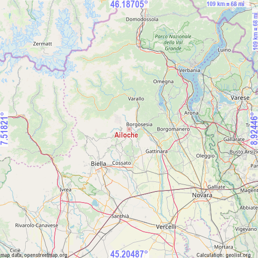
Ailoche GPS coordinates[2]
45° 41' 53.232" North, 8° 13' 16.788" East
| Map corner | latitude | longitude |
|---|---|---|
| Upper-left | 46.18705°, | 7.51821° |
| Center: | 45.69812°, | 8.22133° |
| Lower-right: | 45.20487°, | 8.92446° |
| Map W x H: | 109.2×109.2 km | = 67.9×67.9mi |
| max Lat: | 47.04031° ⇑18.9% North |
| Ailoche: | 45.69812° |
| min Lat: | ⇓81.1% South 35.50142° |
| min Long | Ailoche | max Long |
| 6.69888° | 8.22133° | 18.48682° |
| W 9.1%⇐ | ⇒90.9% E |
Elevation
Elevation of Ailoche is 540 m = 1772 ft, and this is 233.3 m = 765 ft above average elevation for this country.
| Max E: |
2085 m = 6841 ft | 18.9% |
| Ailoche | 540 m 1772 ft | |
| Avg. | 306.7 m = 1006 ft | |
Min E: |
-4 m = -13 ft | 81.1% |
See also: Italy elevation on elevation.city.
Geographical zone
Ailoche is located in North temperate zone (between Tropic of Cancer and the Arctic Circle). Distance of this North polar circle is 2320 km =1441.6 mi to North.| Distance of | km | miles | from Ailoche |
|---|---|---|---|
| North Pole | 4925.9 | 3060.8 | to North |
| Arctic Circle | 2320 | 1441.6 | to North |
| Tropic Cancer | 2475.2 | 1538 | to South |
| Equator | 5081.2 | 3157.3 | to South |


Nearby cities:
15 places around Ailoche: (largest is in red/bold)
• Borgosesia
4.8 km =3 mi,  59°
59°
• Coggiola
3.3 km =2.1 mi,  246°
246°
• Crevacuore
2.3 km =1.4 mi,  128°
128°
• Frazione Chiesa
0.8 km =0.5 mi,  237°
237°
• Giardino-Botto
6.8 km =4.2 mi,  224°
224°
• Guardabosone
2.2 km =1.4 mi,  79°
79°
• Lanvario
6.7 km =4.2 mi,  195°
195°
• Portula
4.6 km =2.9 mi, 236°
• Postua
1.8 km =1.1 mi,  18°
18°
• Pray
2.7 km =1.7 mi, 199°
• Quarona
7.8 km =4.8 mi,  27°
27°
• Serravalle Sesia
6.9 km =4.3 mi,  102°
102°
• Soprana
6.7 km =4.2 mi,  194°
194°
• Sostegno
6.3 km =3.9 mi,  143°
143°
• Trivero-Prativero-Ponzone
5.6 km =3.5 mi, 221°
Sources, notices
• [Note1] Compared only with cities in Italy existing in our database
• [Src1] Map data: © OpenStreetMap contributors (CC-BY-SA)
• [Src2] Other city data from geonames.org with taken over terms of usage.
• [Src3] Geographical zone / Annual Mean Temperature by Robert A. Rohde @ Wikipedia
