Abbiategrasso geodata
Abbiategrasso (Lombardy) is a seat of a third-order administrative division; located in Italy in Europe/Rome (GMT+2) time zone. With population of 30,659 people, there are 270 cities with bigger population in this country. Compared to other cities in Italy, 70.1% of cities are located further ↓South; 82.4% of cities are located further →East and 65.3% of cities have higher elevation than Abbiategrasso. Note1
Administrative division(s):
- Level 1: Lombardy
- Level 2: Città metropolitana di Milano
- Level 3: Abbiategrasso


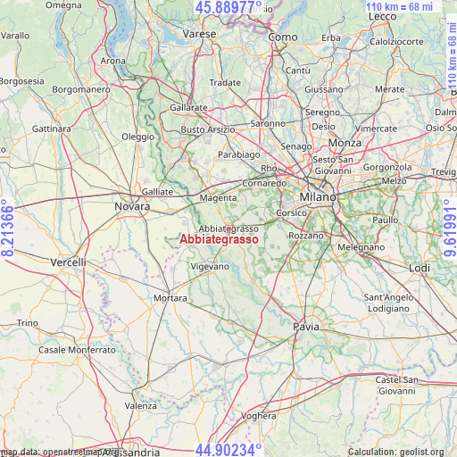
Abbiategrasso GPS coordinates[2]
45° 23' 53.556" North, 8° 55' 0.408" East
| Map corner | latitude | longitude |
|---|---|---|
| Upper-left | 45.88977°, | 8.21366° |
| Center: | 45.39821°, | 8.91678° |
| Lower-right: | 44.90234°, | 9.61991° |
| Map W x H: | 109.8×109.8 km | = 68.2×68.2mi |
| max Lat: | 47.04031° ⇑29.9% North |
| Abbiategrasso: | 45.39821° |
| min Lat: | ⇓70.1% South 35.50142° |
| min Long | Abbiategrasso | max Long |
| 6.69888° | 8.91678° | 18.48682° |
| W 17.6%⇐ | ⇒82.4% E |
Elevation
Elevation of Abbiategrasso is 126 m = 413 ft, and this is 180.7 m = 593 ft below average elevation for this country.
| Max E: |
2085 m = 6841 ft | 65.3% |
| Avg. | 306.7 m = 1006 ft | |
| Abbiategrasso | 126 m = 413 ft | |
Min E: |
-4 m = -13 ft | 34.7% |
See also: Italy elevation on elevation.city.
Geographical zone
Abbiategrasso is located in North temperate zone (between Tropic of Cancer and the Arctic Circle). Distance of this North polar circle is 2353.4 km =1462.3 mi to North.| Distance of | km | miles | from Abbiategrasso |
|---|---|---|---|
| North Pole | 4959.3 | 3081.6 | to North |
| Arctic Circle | 2353.4 | 1462.3 | to North |
| Tropic Cancer | 2441.9 | 1517.3 | to South |
| Equator | 5047.8 | 3136.6 | to South |


Nearby cities:
15 places around Abbiategrasso: (largest is in red/bold)
• Albairate
2.9 km =1.8 mi,  34°
34°
• Cascinazza
3.3 km =2.1 mi,  310°
310°
• Cassinetta di Lugagnano
2.8 km =1.7 mi,  342°
342°
• Castellazzo de' Barzi
5.2 km =3.2 mi, 344°
• Casterno
5.1 km =3.2 mi, 314°
• Cerello-Battuello
5.6 km =3.5 mi,  11°
11°
• Cisliano
7.5 km =4.7 mi,  47°
47°
• Corbetta
7.7 km =4.8 mi,  1°
1°
• Gudo Visconti
7 km =4.3 mi,  112°
112°
• Magenta
7.8 km =4.8 mi, 341°
• Morimondo
5.8 km =3.6 mi,  148°
148°
• Ozzero
3.4 km =2.1 mi,  170°
170°
• Robecco sul Naviglio
4.9 km =3 mi,  330°
330°
• Vermezzo
4.9 km =3 mi,  92°
92°
• Zelo Surrigone
5.5 km =3.4 mi,  102°
102°
Sources, notices
• [Note1] Compared only with cities in Italy existing in our database
• [Src1] Map data: © OpenStreetMap contributors (CC-BY-SA)
• [Src2] Other city data from geonames.org with taken over terms of usage.
• [Src3] Geographical zone / Annual Mean Temperature by Robert A. Rohde @ Wikipedia
