Robecco sul Naviglio geodata
Robecco sul Naviglio (Lombardy) is a seat of a third-order administrative division; located in Italy in Europe/Rome (GMT+2) time zone. With population of 4,176 people, there are 2297 cities with bigger population in this country. Compared to other cities in Italy, 71.4% of cities are located further ↓South; 83% of cities are located further →East and 64.9% of cities have higher elevation than Robecco sul Naviglio. Note1
Administrative division(s):
- Level 1: Lombardy
- Level 2: Città metropolitana di Milano
- Level 3: Robecco sul Naviglio
Current local time in Robecco sul Naviglio:
10:09 PM, WednesdayDifference from your time zone: hours


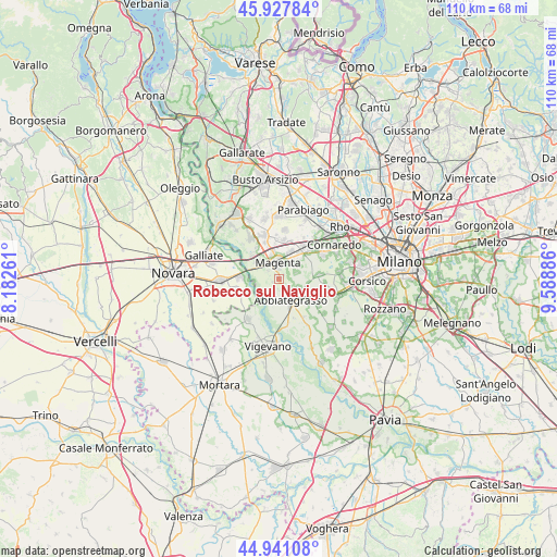
Robecco sul Naviglio GPS coordinates[2]
45° 26' 11.832" North, 8° 53' 8.628" East
| Map corner | latitude | longitude |
|---|---|---|
| Upper-left | 45.92784°, | 8.18261° |
| Center: | 45.43662°, | 8.88573° |
| Lower-right: | 44.94108°, | 9.58886° |
| Map W x H: | 109.7×109.7 km | = 68.2×68.2mi |
| max Lat: | 47.04031° ⇑28.6% North |
| Robecco sul Naviglio: | 45.43662° |
| min Lat: | ⇓71.4% South 35.50142° |
| min Long | Robecco sul Nav | max Long |
| 6.69888° | 8.88573° | 18.48682° |
| W 17%⇐ | ⇒83% E |
Elevation
Elevation of Robecco sul Naviglio is 128 m = 420 ft, and this is 178.7 m = 586 ft below average elevation for this country.
| Max E: |
2085 m = 6841 ft | 64.9% |
| Avg. | 306.7 m = 1006 ft | |
| Robecco sul Naviglio | 128 m = 420 ft | |
Min E: |
-4 m = -13 ft | 35.1% |
See also: Italy elevation on elevation.city.
Geographical zone
Robecco sul Naviglio is located in North temperate zone (between Tropic of Cancer and the Arctic Circle). Distance of this North polar circle is 2349.1 km =1459.7 mi to North.| Distance of | km | miles | from Robecco sul Naviglio |
|---|---|---|---|
| North Pole | 4955 | 3078.9 | to North |
| Arctic Circle | 2349.1 | 1459.7 | to North |
| Tropic Cancer | 2446.2 | 1520 | to South |
| Equator | 5052.1 | 3139.2 | to South |


Nearby cities:
15 places around Robecco sul Naviglio: (largest is in red/bold)
• Abbiategrasso
4.9 km =3 mi,  150°
150°
• Albairate
4.5 km =2.8 mi,  115°
115°
• Bernate Ticino
7 km =4.3 mi,  311°
311°
• Boffalora Sopra Ticino
5.5 km =3.4 mi, 308°
• Cascinazza
2.2 km =1.4 mi,  182°
182°
• Casone
6.9 km =4.3 mi,  353°
353°
• Cassinetta di Lugagnano
2.2 km =1.4 mi,  134°
134°
• Castellazzo
6.2 km =3.9 mi,  47°
47°
• Castellazzo de' Barzi
1.2 km =0.7 mi,  55°
55°
• Casterno
1.4 km =0.9 mi,  239°
239°
• Cerello-Battuello
3.7 km =2.3 mi,  71°
71°
• Corbetta
4.3 km =2.7 mi,  37°
37°
• Magenta
3.1 km =1.9 mi,  358°
358°
• Marcallo
5.3 km =3.3 mi, 348°
• Santo Stefano Ticino
6 km =3.7 mi,  22°
22°
Sources, notices
• [Note1] Compared only with cities in Italy existing in our database
• [Src1] Map data: © OpenStreetMap contributors (CC-BY-SA)
• [Src2] Other city data from geonames.org with taken over terms of usage.
• [Src3] Geographical zone / Annual Mean Temperature by Robert A. Rohde @ Wikipedia
