Villanova geodata
Villanova (Friuli Venezia Giulia) is a populated place; located in Italy in Europe/Rome (GMT+2) time zone. With population of 829 people, there are 7506 cities with bigger population in this country. Compared to other cities in Italy, 90.7% of cities are located further ↓South; 72.6% of cities are located further ←West and 80.3% of cities have higher elevation than Villanova. Note1
Administrative division(s):
- Level 1: Friuli Venezia Giulia
- Level 2: Provincia di Udine
- Level 3: San Giovanni al Natisone


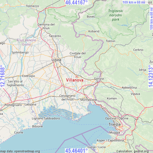
Villanova GPS coordinates[2]
45° 57' 18" North, 13° 25' 12" East
| Map corner | latitude | longitude |
|---|---|---|
| Upper-left | 46.44167°, | 12.71688° |
| Center: | 45.955°, | 13.42° |
| Lower-right: | 45.46401°, | 14.12313° |
| Map W x H: | 108.7×108.7 km | = 67.5×67.5mi |
| max Lat: | 47.04031° ⇑9.3% North |
| Villanova: | 45.955° |
| min Lat: | ⇓90.7% South 35.50142° |
| min Long | Villanova | max Long |
| 6.69888° | 13.42° | 18.48682° |
| W 72.6%⇐ | ⇒27.4% E |
Elevation
Elevation of Villanova is 48 m = 157 ft, and this is 258.7 m = 849 ft below average elevation for this country.
| Max E: |
2085 m = 6841 ft | 80.3% |
| Avg. | 306.7 m = 1006 ft | |
| Villanova | 48 m = 157 ft | |
Min E: |
-4 m = -13 ft | 19.7% |
See also: Italy elevation on elevation.city.
Geographical zone
Villanova is located in North temperate zone (between Tropic of Cancer and the Arctic Circle). Distance of this North polar circle is 2291.5 km =1423.9 mi to North.| Distance of | km | miles | from Villanova |
|---|---|---|---|
| North Pole | 4897.3 | 3043 | to North |
| Arctic Circle | 2291.5 | 1423.9 | to North |
| Tropic Cancer | 2503.8 | 1555.8 | to South |
| Equator | 5109.7 | 3175 | to South |


Nearby cities:
15 places around Villanova: (largest is in red/bold)
• Brazzano
3.5 km =2.2 mi,  49°
49°
• Capriva del Friuli
7.5 km =4.7 mi,  102°
102°
• Chiopris
3.4 km =2.1 mi,  201°
201°
• Cormons
3.6 km =2.2 mi,  89°
89°
• Corno di Rosazzo
4.4 km =2.7 mi,  24°
24°
• Dolegnano
3.2 km =2 mi,  10°
10°
• Ialmicco
7.4 km =4.6 mi,  230°
230°
• Manzano
5 km =3.1 mi,  318°
318°
• Mariano del Friuli
5.4 km =3.4 mi,  145°
145°
• Medea
4.2 km =2.6 mi,  175°
175°
• Medeuzza
2.4 km =1.5 mi, 230°
• Moraro
6.5 km =4 mi,  115°
115°
• San Giovanni al Natisone
2.2 km =1.4 mi, 321°
• San Vito al Torre
7.4 km =4.6 mi,  207°
207°
• Trivignano Udinese
6.3 km =3.9 mi,  260°
260°
Sources, notices
• [Note1] Compared only with cities in Italy existing in our database
• [Src1] Map data: © OpenStreetMap contributors (CC-BY-SA)
• [Src2] Other city data from geonames.org with taken over terms of usage.
• [Src3] Geographical zone / Annual Mean Temperature by Robert A. Rohde @ Wikipedia
