Dolegnano geodata
Dolegnano (Friuli Venezia Giulia) is a populated place; located in Italy in Europe/Rome (GMT+2) time zone. With population of 552 people, there are 9430 cities with bigger population in this country. Compared to other cities in Italy, 91.6% of cities are located further ↓South; 72.7% of cities are located further ←West and 76.5% of cities have higher elevation than Dolegnano. Note1
Administrative division(s):
- Level 1: Friuli Venezia Giulia
- Level 2: Provincia di Udine
- Level 3: San Giovanni al Natisone


Dolegnano GPS coordinates[2]
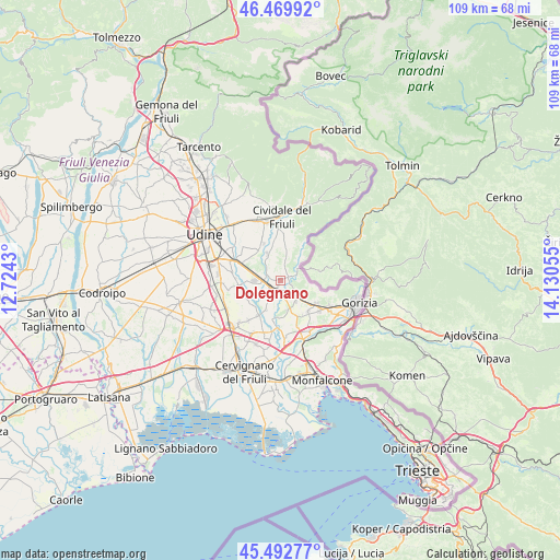
45° 59' 0.6" North, 13° 25' 38.712" East
| Map corner | latitude | longitude |
|---|---|---|
| Upper-left | 46.46992°, | 12.7243° |
| Center: | 45.9835°, | 13.42742° |
| Lower-right: | 45.49277°, | 14.13055° |
| Map W x H: | 108.6×108.6 km | = 67.5×67.5mi |
| max Lat: | 47.04031° ⇑8.4% North |
| Dolegnano: | 45.9835° |
| min Lat: | ⇓91.6% South 35.50142° |
| min Long | Dolegnano | max Long |
| 6.69888° | 13.42742° | 18.48682° |
| W 72.7%⇐ | ⇒27.3% E |
Elevation
Elevation of Dolegnano is 67 m = 220 ft, and this is 239.7 m = 786 ft below average elevation for this country.
| Max E: |
2085 m = 6841 ft | 76.5% |
| Avg. | 306.7 m = 1006 ft | |
| Dolegnano | 67 m = 220 ft | |
Min E: |
-4 m = -13 ft | 23.5% |
See also: Italy elevation on elevation.city.
Geographical zone
Dolegnano is located in North temperate zone (between Tropic of Cancer and the Arctic Circle). Distance of this North polar circle is 2288.3 km =1421.9 mi to North.| Distance of | km | miles | from Dolegnano |
|---|---|---|---|
| North Pole | 4894.2 | 3041.1 | to North |
| Arctic Circle | 2288.3 | 1421.9 | to North |
| Tropic Cancer | 2507 | 1557.8 | to South |
| Equator | 5112.9 | 3177 | to South |


Nearby cities:
15 places around Dolegnano: (largest is in red/bold)
• Brazzano
2.3 km =1.4 mi,  112°
112°
• Buttrio
7.9 km =4.9 mi,  292°
292°
• Chiopris
6.6 km =4.1 mi,  195°
195°
• Cormons
4.4 km =2.7 mi,  135°
135°
• Corno di Rosazzo
1.5 km =0.9 mi,  56°
56°
• Dolegna del Collio
6.6 km =4.1 mi,  36°
36°
• Ipplis
6.8 km =4.2 mi,  348°
348°
• Manzano
4 km =2.5 mi,  277°
277°
• Medea
7.3 km =4.5 mi,  181°
181°
• Medeuzza
5.3 km =3.3 mi,  207°
207°
• Orsaria
7 km =4.3 mi,  330°
330°
• Prepotto
7.9 km =4.9 mi,  30°
30°
• San Giovanni al Natisone
2.4 km =1.5 mi,  234°
234°
• Trivignano Udinese
7.9 km =4.9 mi,  238°
238°
• Villanova
3.2 km =2 mi,  190°
190°
Sources, notices
• [Note1] Compared only with cities in Italy existing in our database
• [Src1] Map data: © OpenStreetMap contributors (CC-BY-SA)
• [Src2] Other city data from geonames.org with taken over terms of usage.
• [Src3] Geographical zone / Annual Mean Temperature by Robert A. Rohde @ Wikipedia
