Soccher-Paiane-Casan-Arsie geodata
Soccher-Paiane-Casan-Arsie (Veneto) is a populated place; located in Italy in Europe/Rome (GMT+2) time zone. With population of 1,371 people, there are 5437 cities with bigger population in this country. Compared to other cities in Italy, 95.8% of cities are located further ↓South; 60.1% of cities are located further ←West and 70.8% of cities have lower elevation than Soccher-Paiane-Casan-Arsie. Note1
Current local time in Soccher-Paiane-Casan-Arsie:
11:47 PM, SundayDifference from your time zone: hours


Soccher-Paiane-Casan-Arsie GPS coordinates[2]
46° 10' 52.32" North, 12° 18' 36.036" East
| Map corner | latitude | longitude |
|---|---|---|
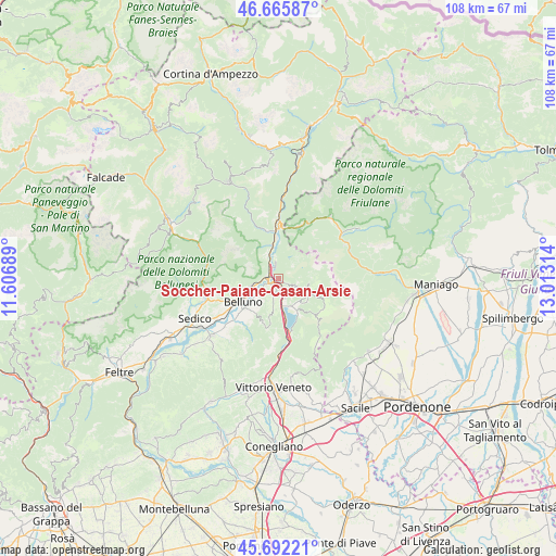
| Upper-left | 46.66587°, | 11.60689° |
| Center: | 46.1812°, | 12.31001° |
| Lower-right: | 45.69221°, | 13.01314° |
| Map W x H: | 108.3×108.3 km | = 67.3×67.3mi |
| max Lat: | 47.04031° ⇑4.2% North |
| Soccher-Paiane-Casan-Arsie: | 46.1812° |
| min Lat: | ⇓95.8% South 35.50142° |
| min Long | Soccher-Paiane- | max Long |
| 6.69888° | 12.31001° | 18.48682° |
| W 60.1%⇐ | ⇒39.9% E |
Elevation
Elevation of Soccher-Paiane-Casan-Arsie is 402 m = 1319 ft, and this is 95.3 m = 313 ft above average elevation for this country.
| Max E: |
2085 m = 6841 ft | 29.2% |
| Soccher-Paiane-Casan-Arsie | 402 m 1319 ft | |
| Avg. | 306.7 m = 1006 ft | |
Min E: |
-4 m = -13 ft | 70.8% |
See also: Italy elevation on elevation.city.
Geographical zone
Soccher-Paiane-Casan-Arsie is located in North temperate zone (between Tropic of Cancer and the Arctic Circle). Distance of this North polar circle is 2266.3 km =1408.2 mi to North.| Distance of | km | miles | from Soccher-Paiane-Casan-Arsie |
|---|---|---|---|
| North Pole | 4872.2 | 3027.4 | to North |
| Arctic Circle | 2266.3 | 1408.2 | to North |
| Tropic Cancer | 2528.9 | 1571.4 | to South |
| Equator | 5134.9 | 3190.7 | to South |


Nearby cities:
15 places around Soccher-Paiane-Casan-Arsie: (largest is in red/bold)
• Belluno
8.4 km =5.2 mi,  239°
239°
• Bolzano
9.7 km =6 mi,  257°
257°
• Caleipo-Sossai
7.7 km =4.8 mi,  214°
214°
• Castion
8.8 km =5.5 mi,  220°
220°
• Cornei
7.1 km =4.4 mi,  129°
129°
• Farra d'Alpago
7.7 km =4.8 mi,  150°
150°
• Fortogna
5.7 km =3.5 mi,  343°
343°
• Lamosano
6 km =3.7 mi,  99°
99°
• Levego
4.4 km =2.7 mi,  232°
232°
• Longarone
9.4 km =5.8 mi,  355°
355°
• Pieve d'Alpago
3.7 km =2.3 mi,  115°
115°
• Ponte nelle Alpi
2.1 km =1.3 mi,  268°
268°
• Ponte nelle Alpi-Polpet
2.6 km =1.6 mi,  288°
288°
• Puos d'Alpago
5.9 km =3.7 mi,  137°
137°
• Soverzene
2.5 km =1.6 mi,  347°
347°
Sources, notices
• [Note1] Compared only with cities in Italy existing in our database
• [Src1] Map data: © OpenStreetMap contributors (CC-BY-SA)
• [Src2] Other city data from geonames.org with taken over terms of usage.
• [Src3] Geographical zone / Annual Mean Temperature by Robert A. Rohde @ Wikipedia
