Marsure geodata
Marsure (Friuli Venezia Giulia) is a populated place; located in Italy in Europe/Rome (GMT+2) time zone. With population of 1,282 people, there are 5691 cities with bigger population in this country. Compared to other cities in Italy, 94% of cities are located further ↓South; 63.6% of cities are located further ←West and 52.7% of cities have higher elevation than Marsure. Note1
Administrative division(s):
- Level 1: Friuli Venezia Giulia
- Level 2: Provincia di Pordenone
- Level 3: Aviano


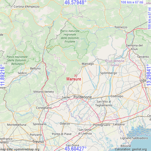
Marsure GPS coordinates[2]
46° 5' 38.508" North, 12° 35' 43.008" East
| Map corner | latitude | longitude |
|---|---|---|
| Upper-left | 46.57948°, | 11.89216° |
| Center: | 46.09403°, | 12.59528° |
| Lower-right: | 45.60427°, | 13.29841° |
| Map W x H: | 108.4×108.4 km | = 67.4×67.4mi |
| max Lat: | 47.04031° ⇑6% North |
| Marsure: | 46.09403° |
| min Lat: | ⇓94% South 35.50142° |
| min Long | Marsure | max Long |
| 6.69888° | 12.59528° | 18.48682° |
| W 63.6%⇐ | ⇒36.4% E |
Elevation
Elevation of Marsure is 218 m = 715 ft, and this is 88.7 m = 291 ft below average elevation for this country.
| Max E: |
2085 m = 6841 ft | 52.7% |
| Avg. | 306.7 m = 1006 ft | |
| Marsure | 218 m = 715 ft | |
Min E: |
-4 m = -13 ft | 47.3% |
See also: Italy elevation on elevation.city.
Geographical zone
Marsure is located in North temperate zone (between Tropic of Cancer and the Arctic Circle). Distance of this North polar circle is 2276 km =1414.2 mi to North.| Distance of | km | miles | from Marsure |
|---|---|---|---|
| North Pole | 4881.9 | 3033.5 | to North |
| Arctic Circle | 2276 | 1414.2 | to North |
| Tropic Cancer | 2519.3 | 1565.4 | to South |
| Equator | 5125.2 | 3184.7 | to South |


Nearby cities:
15 places around Marsure: (largest is in red/bold)
• Aviano
2.6 km =1.6 mi,  180°
180°
• Aviano-Castello
3.1 km =1.9 mi,  197°
197°
• Barcis
11.1 km =6.9 mi,  346°
346°
• Budoia
7.2 km =4.5 mi,  220°
220°
• Giais
2.9 km =1.8 mi,  22°
22°
• Montereale Valcellina
7.5 km =4.7 mi,  32°
32°
• Polcenigo
9.4 km =5.8 mi,  228°
228°
• Roveredo in Piano
9.7 km =6 mi,  168°
168°
• San Foca
8.6 km =5.3 mi,  116°
116°
• San Giovanni
10.2 km =6.3 mi, 217°
• San Leonardo
6.7 km =4.2 mi,  86°
86°
• San Martino Di Campagna
5 km =3.1 mi, 118°
• San Quirino
9.3 km =5.8 mi,  136°
136°
• Sedrano
7.1 km =4.4 mi,  130°
130°
• Vajont
9.7 km =6 mi,  53°
53°
Sources, notices
• [Note1] Compared only with cities in Italy existing in our database
• [Src1] Map data: © OpenStreetMap contributors (CC-BY-SA)
• [Src2] Other city data from geonames.org with taken over terms of usage.
• [Src3] Geographical zone / Annual Mean Temperature by Robert A. Rohde @ Wikipedia
