San Giovanni geodata
San Giovanni (Friuli Venezia Giulia) is a populated place; located in Italy in Europe/Rome (GMT+2) time zone. With population of 1,356 people, there are 5478 cities with bigger population in this country. Compared to other cities in Italy, 92.4% of cities are located further ↓South; 62.6% of cities are located further ←West and 79.9% of cities have higher elevation than San Giovanni. Note1
Administrative division(s):
- Level 1: Friuli Venezia Giulia
- Level 2: Provincia di Pordenone
- Level 3: Polcenigo


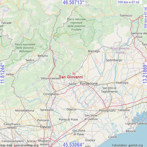
San Giovanni GPS coordinates[2]
46° 1' 15.744" North, 12° 30' 56.016" East
| Map corner | latitude | longitude |
|---|---|---|
| Upper-left | 46.50713°, | 11.81244° |
| Center: | 46.02104°, | 12.51556° |
| Lower-right: | 45.53064°, | 13.21869° |
| Map W x H: | 108.6×108.6 km | = 67.5×67.5mi |
| max Lat: | 47.04031° ⇑7.6% North |
| San Giovanni: | 46.02104° |
| min Lat: | ⇓92.4% South 35.50142° |
| min Long | San Giovanni | max Long |
| 6.69888° | 12.51556° | 18.48682° |
| W 62.6%⇐ | ⇒37.4% E |
Elevation
Elevation of San Giovanni is 50 m = 164 ft, and this is 256.7 m = 842 ft below average elevation for this country.
| Max E: |
2085 m = 6841 ft | 79.9% |
| Avg. | 306.7 m = 1006 ft | |
| San Giovanni | 50 m = 164 ft | |
Min E: |
-4 m = -13 ft | 20.1% |
See also: Italy elevation on elevation.city.
Geographical zone
San Giovanni is located in North temperate zone (between Tropic of Cancer and the Arctic Circle). Distance of this North polar circle is 2284.1 km =1419.3 mi to North.| Distance of | km | miles | from San Giovanni |
|---|---|---|---|
| North Pole | 4890 | 3038.5 | to North |
| Arctic Circle | 2284.1 | 1419.3 | to North |
| Tropic Cancer | 2511.1 | 1560.3 | to South |
| Equator | 5117.1 | 3179.6 | to South |


Nearby cities:
15 places around San Giovanni: (largest is in red/bold)
• Aviano
8.2 km =5.1 mi,  47°
47°
• Aviano-Castello
7.4 km =4.6 mi, 45°
• Budoia
3 km =1.9 mi,  28°
28°
• Caneva
7.4 km =4.6 mi,  221°
221°
• Cavolano-Schiavoi
9.8 km =6.1 mi,  187°
187°
• Ceolini
7.5 km =4.7 mi,  116°
116°
• Marsure
10.2 km =6.3 mi,  37°
37°
• Nave
4.8 km =3 mi, 191°
• Palse
10.8 km =6.7 mi,  139°
139°
• Polcenigo
2.1 km =1.3 mi,  333°
333°
• Porcia
10.1 km =6.3 mi,  129°
129°
• Roveredo in Piano
8.1 km =5 mi,  99°
99°
• Sacile
7.5 km =4.7 mi, 187°
• Vigonovo-Fontanafredda
4.3 km =2.7 mi,  145°
145°
• Villa di Villa
9.9 km =6.2 mi,  231°
231°
Sources, notices
• [Note1] Compared only with cities in Italy existing in our database
• [Src1] Map data: © OpenStreetMap contributors (CC-BY-SA)
• [Src2] Other city data from geonames.org with taken over terms of usage.
• [Src3] Geographical zone / Annual Mean Temperature by Robert A. Rohde @ Wikipedia
