Bedizzole geodata
Bedizzole (Lombardy) is a seat of a third-order administrative division; located in Italy in Europe/Rome (GMT+2) time zone. With population of 9,320 people, there are 1014 cities with bigger population in this country. Compared to other cities in Italy, 74% of cities are located further ↓South; 63.7% of cities are located further →East and 59.1% of cities have higher elevation than Bedizzole. Note1


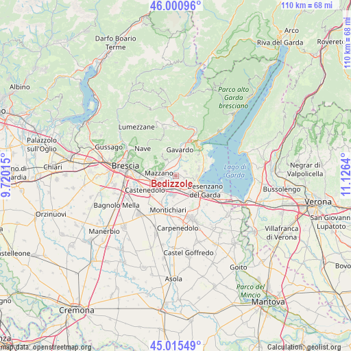
Bedizzole GPS coordinates[2]
45° 30' 37.368" North, 10° 25' 23.772" East
| Map corner | latitude | longitude |
|---|---|---|
| Upper-left | 46.00096°, | 9.72015° |
| Center: | 45.51038°, | 10.42327° |
| Lower-right: | 45.01549°, | 11.1264° |
| Map W x H: | 109.6×109.6 km | = 68.1×68.1mi |
| max Lat: | 47.04031° ⇑26% North |
| Bedizzole: | 45.51038° |
| min Lat: | ⇓74% South 35.50142° |
| min Long | Bedizzole | max Long |
| 6.69888° | 10.42327° | 18.48682° |
| W 36.3%⇐ | ⇒63.7% E |
Elevation
Elevation of Bedizzole is 170 m = 558 ft, and this is 136.7 m = 448 ft below average elevation for this country.
| Max E: |
2085 m = 6841 ft | 59.1% |
| Avg. | 306.7 m = 1006 ft | |
| Bedizzole | 170 m = 558 ft | |
Min E: |
-4 m = -13 ft | 40.9% |
See also: Italy elevation on elevation.city.
Geographical zone
Bedizzole is located in North temperate zone (between Tropic of Cancer and the Arctic Circle). Distance of this North polar circle is 2340.9 km =1454.6 mi to North.| Distance of | km | miles | from Bedizzole |
|---|---|---|---|
| North Pole | 4946.8 | 3073.8 | to North |
| Arctic Circle | 2340.9 | 1454.6 | to North |
| Tropic Cancer | 2454.4 | 1525.1 | to South |
| Equator | 5060.3 | 3144.3 | to South |


Nearby cities:
15 places around Bedizzole: (largest is in red/bold)
• Barcuzzi
6.2 km =3.9 mi,  115°
115°
• Calcinato
6 km =3.7 mi,  190°
190°
• Calvagese della Riviera
3.7 km =2.3 mi,  28°
28°
• Campagnola
3.1 km =1.9 mi,  203°
203°
• Carzago Riviera
3.3 km =2.1 mi,  61°
61°
• Mazzano
5.5 km =3.4 mi,  281°
281°
• Molinetto
5.3 km =3.3 mi,  250°
250°
• Nuvolento
4.8 km =3 mi,  325°
325°
• Nuvolera
4.9 km =3 mi,  299°
299°
• Paitone
4.9 km =3 mi,  340°
340°
• Patuzza
3.5 km =2.2 mi,  274°
274°
• Piazza
0.1 km =0.1 mi,  151°
151°
• Ponte San Marco
3.8 km =2.4 mi, 191°
• Prevalle
4.6 km =2.9 mi,  358°
358°
• Sedena
4.7 km =2.9 mi, 124°
Sources, notices
• [Note1] Compared only with cities in Italy existing in our database
• [Src1] Map data: © OpenStreetMap contributors (CC-BY-SA)
• [Src2] Other city data from geonames.org with taken over terms of usage.
• [Src3] Geographical zone / Annual Mean Temperature by Robert A. Rohde @ Wikipedia
