Sedena geodata
Sedena (Lombardy) is a populated place; located in Italy in Europe/Rome (GMT+2) time zone. With population of 550 people, there are 9451 cities with bigger population in this country. Compared to other cities in Italy, 73.1% of cities are located further ↓South; 63.1% of cities are located further →East and 57.9% of cities have higher elevation than Sedena. Note1
Administrative division(s):
- Level 1: Lombardy
- Level 2: Provincia di Brescia
- Level 3: Lonato del Garda


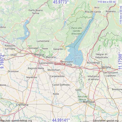
Sedena GPS coordinates[2]
45° 29' 11.436" North, 10° 28' 22.26" East
| Map corner | latitude | longitude |
|---|---|---|
| Upper-left | 45.9773°, | 9.76972° |
| Center: | 45.48651°, | 10.47285° |
| Lower-right: | 44.99141°, | 11.17598° |
| Map W x H: | 109.6×109.6 km | = 68.1×68.1mi |
| max Lat: | 47.04031° ⇑26.9% North |
| Sedena: | 45.48651° |
| min Lat: | ⇓73.1% South 35.50142° |
| min Long | Sedena | max Long |
| 6.69888° | 10.47285° | 18.48682° |
| W 36.9%⇐ | ⇒63.1% E |
Elevation
Elevation of Sedena is 180 m = 591 ft, and this is 126.7 m = 416 ft below average elevation for this country.
| Max E: |
2085 m = 6841 ft | 57.9% |
| Avg. | 306.7 m = 1006 ft | |
| Sedena | 180 m = 591 ft | |
Min E: |
-4 m = -13 ft | 42.1% |
See also: Italy elevation on elevation.city.
Geographical zone
Sedena is located in North temperate zone (between Tropic of Cancer and the Arctic Circle). Distance of this North polar circle is 2343.5 km =1456.2 mi to North.| Distance of | km | miles | from Sedena |
|---|---|---|---|
| North Pole | 4949.4 | 3075.4 | to North |
| Arctic Circle | 2343.5 | 1456.2 | to North |
| Tropic Cancer | 2451.7 | 1523.4 | to South |
| Equator | 5057.6 | 3142.6 | to South |


Nearby cities:
15 places around Sedena: (largest is in red/bold)
• Barcuzzi
1.7 km =1.1 mi,  89°
89°
• Bedizzole
4.7 km =2.9 mi,  304°
304°
• Calcinato
5.9 km =3.7 mi,  236°
236°
• Calvagese della Riviera
6.2 km =3.9 mi,  340°
340°
• Campagnola
5.1 km =3.2 mi,  267°
267°
• Carzago Riviera
4.3 km =2.7 mi,  347°
347°
• Desenzano del Garda
5.2 km =3.2 mi,  109°
109°
• Esenta
7.8 km =4.8 mi,  175°
175°
• Lonato
2.9 km =1.8 mi,  173°
173°
• Moniga del Garda
6.7 km =4.2 mi,  48°
48°
• Padenghe sul Garda
4.3 km =2.7 mi,  56°
56°
• Piazza
4.6 km =2.9 mi, 303°
• Polpenazze del Garda
7.6 km =4.7 mi,  19°
19°
• Ponte San Marco
4.8 km =3 mi,  257°
257°
• Soiano
5.5 km =3.4 mi,  34°
34°
Sources, notices
• [Note1] Compared only with cities in Italy existing in our database
• [Src1] Map data: © OpenStreetMap contributors (CC-BY-SA)
• [Src2] Other city data from geonames.org with taken over terms of usage.
• [Src3] Geographical zone / Annual Mean Temperature by Robert A. Rohde @ Wikipedia
