Prevalle geodata
Prevalle (Lombardy) is a seat of a third-order administrative division; located in Italy in Europe/Rome (GMT+2) time zone. With population of 6,476 people, there are 1509 cities with bigger population in this country. Compared to other cities in Italy, 75.3% of cities are located further ↓South; 63.7% of cities are located further →East and 56.4% of cities have higher elevation than Prevalle. Note1


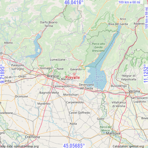
Prevalle GPS coordinates[2]
45° 33' 4.968" North, 10° 25' 19.452" East
| Map corner | latitude | longitude |
|---|---|---|
| Upper-left | 46.0416°, | 9.71895° |
| Center: | 45.55138°, | 10.42207° |
| Lower-right: | 45.05685°, | 11.1252° |
| Map W x H: | 109.5×109.5 km | = 68×68mi |
| max Lat: | 47.04031° ⇑24.7% North |
| Prevalle: | 45.55138° |
| min Lat: | ⇓75.3% South 35.50142° |
| min Long | Prevalle | max Long |
| 6.69888° | 10.42207° | 18.48682° |
| W 36.3%⇐ | ⇒63.7% E |
Elevation
Elevation of Prevalle is 192 m = 630 ft, and this is 114.7 m = 376 ft below average elevation for this country.
| Max E: |
2085 m = 6841 ft | 56.4% |
| Avg. | 306.7 m = 1006 ft | |
| Prevalle | 192 m = 630 ft | |
Min E: |
-4 m = -13 ft | 43.6% |
See also: Italy elevation on elevation.city.
Geographical zone
Prevalle is located in North temperate zone (between Tropic of Cancer and the Arctic Circle). Distance of this North polar circle is 2336.3 km =1451.7 mi to North.| Distance of | km | miles | from Prevalle |
|---|---|---|---|
| North Pole | 4942.2 | 3070.9 | to North |
| Arctic Circle | 2336.3 | 1451.7 | to North |
| Tropic Cancer | 2458.9 | 1527.9 | to South |
| Equator | 5064.8 | 3147.1 | to South |


Nearby cities:
15 places around Prevalle: (largest is in red/bold)
• Bedizzole
4.6 km =2.9 mi,  178°
178°
• Calvagese della Riviera
2.3 km =1.4 mi,  125°
125°
• Carzago Riviera
4.2 km =2.6 mi,  135°
135°
• Chiesa
3.4 km =2.1 mi,  66°
66°
• Gavardo-Sopraponte
4.5 km =2.8 mi,  20°
20°
• Muscoline
3.3 km =2.1 mi, 68°
• Nuvolento
2.7 km =1.7 mi,  257°
257°
• Nuvolera
4.6 km =2.9 mi,  242°
242°
• Paitone
1.5 km =0.9 mi,  272°
272°
• Patuzza
5.5 km =3.4 mi,  218°
218°
• Piazza
4.7 km =2.9 mi, 178°
• San Biagio
5.2 km =3.2 mi,  37°
37°
• San Giacomo
6.4 km =4 mi, 42°
• Serle
4.3 km =2.7 mi,  284°
284°
• Villanuova sul Clisi
5.8 km =3.6 mi, 24°
Sources, notices
• [Note1] Compared only with cities in Italy existing in our database
• [Src1] Map data: © OpenStreetMap contributors (CC-BY-SA)
• [Src2] Other city data from geonames.org with taken over terms of usage.
• [Src3] Geographical zone / Annual Mean Temperature by Robert A. Rohde @ Wikipedia
