Bellizzi geodata
Bellizzi (Campania) is a seat of a third-order administrative division; located in Italy in Europe/Rome (GMT+2) time zone. With population of 10,811 people, there are 877 cities with bigger population in this country. Compared to other cities in Italy, 83.3% of cities are located further ↑North; 86.7% of cities are located further ←West and 77.5% of cities have higher elevation than Bellizzi. Note1


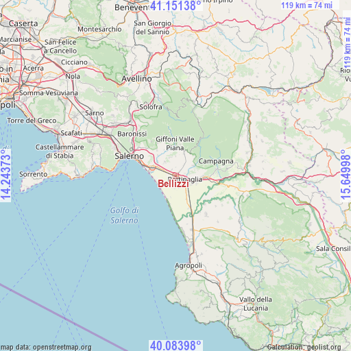
Bellizzi GPS coordinates[2]
40° 37' 11.316" North, 14° 56' 48.66" East
| Map corner | latitude | longitude |
|---|---|---|
| Upper-left | 41.15138°, | 14.24373° |
| Center: | 40.61981°, | 14.94685° |
| Lower-right: | 40.08398°, | 15.64998° |
| Map W x H: | 118.7×118.7 km | = 73.8×73.8mi |
| max Lat: | 47.04031° ⇑83.3% North |
| Bellizzi: | 40.61981° |
| min Lat: | ⇓16.7% South 35.50142° |
| min Long | Bellizzi | max Long |
| 6.69888° | 14.94685° | 18.48682° |
| W 86.7%⇐ | ⇒13.3% E |
Elevation
Elevation of Bellizzi is 62 m = 203 ft, and this is 244.7 m = 803 ft below average elevation for this country.
| Max E: |
2085 m = 6841 ft | 77.5% |
| Avg. | 306.7 m = 1006 ft | |
| Bellizzi | 62 m = 203 ft | |
Min E: |
-4 m = -13 ft | 22.5% |
See also: Italy elevation on elevation.city.
Geographical zone
Bellizzi is located in North temperate zone (between Tropic of Cancer and the Arctic Circle). Distance of this Northern Tropic circle is 1910.6 km =1187.2 mi to South.| Distance of | km | miles | from Bellizzi |
|---|---|---|---|
| North Pole | 5490.6 | 3411.7 | to North |
| Arctic Circle | 2884.7 | 1792.5 | to North |
| Tropic Cancer | 1910.6 | 1187.2 | to South |
| Equator | 4516.5 | 2806.4 | to South |


Nearby cities:
15 places around Bellizzi: (largest is in red/bold)
• Ariano
7.8 km =4.8 mi,  58°
58°
• Battipaglia
3.2 km =2 mi,  112°
112°
• Corvinia
3.2 km =2 mi,  278°
278°
• Faiano
6.1 km =3.8 mi,  321°
321°
• Macchia
4.6 km =2.9 mi,  35°
35°
• Magazzeno
7.7 km =4.8 mi,  262°
262°
• Montecorvino Pugliano
6.6 km =4.1 mi,  358°
358°
• Monticelli
6.8 km =4.2 mi, 60°
• Olevano sul Tusciano
7.7 km =4.8 mi, 57°
• Pagliarone
3.1 km =1.9 mi,  291°
291°
• Pontecagnano
6.6 km =4.1 mi, 294°
• Pratole
1.9 km =1.2 mi, 290°
• Pugliano
6.6 km =4.1 mi, 358°
• Sant'Antonio
4.5 km =2.8 mi, 294°
• Santa Tecla-Castelpagano
6.4 km =4 mi,  337°
337°
Sources, notices
• [Note1] Compared only with cities in Italy existing in our database
• [Src1] Map data: © OpenStreetMap contributors (CC-BY-SA)
• [Src2] Other city data from geonames.org with taken over terms of usage.
• [Src3] Geographical zone / Annual Mean Temperature by Robert A. Rohde @ Wikipedia
