Macchia geodata
Macchia (Campania) is a populated place; located in Italy in Europe/Rome (GMT+2) time zone. With population of 1,933 people, there are 4269 cities with bigger population in this country. Compared to other cities in Italy, 82.9% of cities are located further ↑North; 87% of cities are located further ←West and 63.4% of cities have higher elevation than Macchia. Note1
Administrative division(s):
- Level 1: Campania
- Level 2: Provincia di Salerno
- Level 3: Montecorvino Rovella


Macchia GPS coordinates[2]
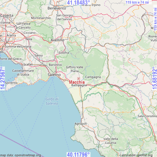
40° 39' 12.708" North, 14° 58' 43.644" East
| Map corner | latitude | longitude |
|---|---|---|
| Upper-left | 41.18483°, | 14.27567° |
| Center: | 40.65353°, | 14.97879° |
| Lower-right: | 40.11796°, | 15.68192° |
| Map W x H: | 118.6×118.6 km | = 73.7×73.7mi |
| max Lat: | 47.04031° ⇑82.9% North |
| Macchia: | 40.65353° |
| min Lat: | ⇓17.1% South 35.50142° |
| min Long | Macchia | max Long |
| 6.69888° | 14.97879° | 18.48682° |
| W 87%⇐ | ⇒13% E |
Elevation
Elevation of Macchia is 138 m = 453 ft, and this is 168.7 m = 553 ft below average elevation for this country.
| Max E: |
2085 m = 6841 ft | 63.4% |
| Avg. | 306.7 m = 1006 ft | |
| Macchia | 138 m = 453 ft | |
Min E: |
-4 m = -13 ft | 36.6% |
See also: Italy elevation on elevation.city.
Geographical zone
Macchia is located in North temperate zone (between Tropic of Cancer and the Arctic Circle). Distance of this Northern Tropic circle is 1914.3 km =1189.5 mi to South.| Distance of | km | miles | from Macchia |
|---|---|---|---|
| North Pole | 5486.8 | 3409.3 | to North |
| Arctic Circle | 2880.9 | 1790.1 | to North |
| Tropic Cancer | 1914.3 | 1189.5 | to South |
| Equator | 4520.2 | 2808.7 | to South |


Nearby cities:
15 places around Macchia: (largest is in red/bold)
• Ariano
3.9 km =2.4 mi,  84°
84°
• Battipaglia
5 km =3.1 mi,  176°
176°
• Bellizzi
4.6 km =2.9 mi,  215°
215°
• Corvinia
6.7 km =4.2 mi,  240°
240°
• Faiano
6.5 km =4 mi,  278°
278°
• Gauro
6.8 km =4.2 mi,  349°
349°
• Montecorvino Pugliano
4 km =2.5 mi,  314°
314°
• Montecorvino Rovella
4.3 km =2.7 mi,  359°
359°
• Monticelli
3.2 km =2 mi,  97°
97°
• Olevano sul Tusciano
3.8 km =2.4 mi, 83°
• Pagliarone
6.1 km =3.8 mi, 244°
• Pratole
5.4 km =3.4 mi, 235°
• Pugliano
4 km =2.5 mi, 314°
• Salitto-Valle
4.3 km =2.7 mi,  58°
58°
• Santa Tecla-Castelpagano
5.6 km =3.5 mi,  293°
293°
Sources, notices
• [Note1] Compared only with cities in Italy existing in our database
• [Src1] Map data: © OpenStreetMap contributors (CC-BY-SA)
• [Src2] Other city data from geonames.org with taken over terms of usage.
• [Src3] Geographical zone / Annual Mean Temperature by Robert A. Rohde @ Wikipedia
