Faiano geodata
Faiano (Campania) is a populated place; located in Italy in Europe/Rome (GMT+2) time zone. With population of 4,087 people, there are 2346 cities with bigger population in this country. Compared to other cities in Italy, 82.8% of cities are located further ↑North; 86.4% of cities are located further ←West and 62.1% of cities have higher elevation than Faiano. Note1
Administrative division(s):
- Level 1: Campania
- Level 2: Provincia di Salerno
- Level 3: Pontecagnano Faiano


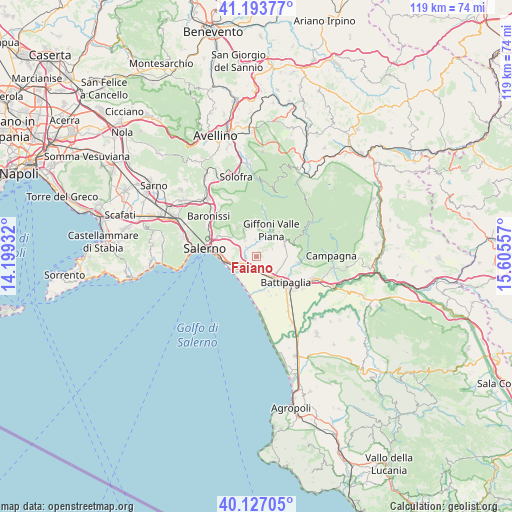
Faiano GPS coordinates[2]
40° 39' 45.144" North, 14° 54' 8.784" East
| Map corner | latitude | longitude |
|---|---|---|
| Upper-left | 41.19377°, | 14.19932° |
| Center: | 40.66254°, | 14.90244° |
| Lower-right: | 40.12705°, | 15.60557° |
| Map W x H: | 118.6×118.6 km | = 73.7×73.7mi |
| max Lat: | 47.04031° ⇑82.8% North |
| Faiano: | 40.66254° |
| min Lat: | ⇓17.2% South 35.50142° |
| min Long | Faiano | max Long |
| 6.69888° | 14.90244° | 18.48682° |
| W 86.4%⇐ | ⇒13.6% E |
Elevation
Elevation of Faiano is 148 m = 486 ft, and this is 158.7 m = 521 ft below average elevation for this country.
| Max E: |
2085 m = 6841 ft | 62.1% |
| Avg. | 306.7 m = 1006 ft | |
| Faiano | 148 m = 486 ft | |
Min E: |
-4 m = -13 ft | 37.9% |
See also: Italy elevation on elevation.city.
Geographical zone
Faiano is located in North temperate zone (between Tropic of Cancer and the Arctic Circle). Distance of this Northern Tropic circle is 1915.3 km =1190.1 mi to South.| Distance of | km | miles | from Faiano |
|---|---|---|---|
| North Pole | 5485.8 | 3408.7 | to North |
| Arctic Circle | 2879.9 | 1789.5 | to North |
| Tropic Cancer | 1915.3 | 1190.1 | to South |
| Equator | 4521.3 | 2809.4 | to South |


Nearby cities:
15 places around Faiano: (largest is in red/bold)
• Bellizzi
6.1 km =3.8 mi,  141°
141°
• Campigliano
3.3 km =2.1 mi,  311°
311°
• Capitignano
6.2 km =3.9 mi,  1°
1°
• Casa Rocco d'Amato
6.3 km =3.9 mi,  287°
287°
• Corvinia
4.3 km =2.7 mi,  172°
172°
• Fuorni
5.1 km =3.2 mi,  241°
241°
• Malche-Santa Croce-Serroni
5.2 km =3.2 mi, 3°
• Montecorvino Pugliano
4 km =2.5 mi,  62°
62°
• Pagliarone
3.7 km =2.3 mi, 165°
• Pezzano-Filetta
4.8 km =3 mi,  324°
324°
• Pontecagnano
3 km =1.9 mi,  227°
227°
• Pratole
4.5 km =2.8 mi,  154°
154°
• Pugliano
4 km =2.5 mi, 63°
• Sant'Antonio
2.9 km =1.8 mi,  186°
186°
• Santa Tecla-Castelpagano
1.8 km =1.1 mi,  47°
47°
Sources, notices
• [Note1] Compared only with cities in Italy existing in our database
• [Src1] Map data: © OpenStreetMap contributors (CC-BY-SA)
• [Src2] Other city data from geonames.org with taken over terms of usage.
• [Src3] Geographical zone / Annual Mean Temperature by Robert A. Rohde @ Wikipedia
