Bernareggio geodata
Bernareggio (Lombardy) is a seat of a third-order administrative division; located in Italy in Europe/Rome (GMT+2) time zone. With population of 9,061 people, there are 1044 cities with bigger population in this country. Compared to other cities in Italy, 78.9% of cities are located further ↓South; 74.4% of cities are located further →East and 50.2% of cities have higher elevation than Bernareggio. Note1
Administrative division(s):
- Level 1: Lombardy
- Level 2: Provincia di Monza e della Brianza
- Level 3: Bernareggio


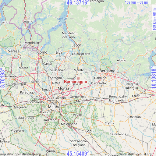
Bernareggio GPS coordinates[2]
45° 38' 52.008" North, 9° 24' 18.18" East
| Map corner | latitude | longitude |
|---|---|---|
| Upper-left | 46.13716°, | 8.70193° |
| Center: | 45.64778°, | 9.40505° |
| Lower-right: | 45.15409°, | 10.10818° |
| Map W x H: | 109.3×109.3 km | = 67.9×67.9mi |
| max Lat: | 47.04031° ⇑21.1% North |
| Bernareggio: | 45.64778° |
| min Lat: | ⇓78.9% South 35.50142° |
| min Long | Bernareggio | max Long |
| 6.69888° | 9.40505° | 18.48682° |
| W 25.6%⇐ | ⇒74.4% E |
Elevation
Elevation of Bernareggio is 234 m = 768 ft, and this is 72.7 m = 239 ft below average elevation for this country.
| Max E: |
2085 m = 6841 ft | 50.2% |
| Avg. | 306.7 m = 1006 ft | |
| Bernareggio | 234 m = 768 ft | |
Min E: |
-4 m = -13 ft | 49.8% |
See also: Italy elevation on elevation.city.
Geographical zone
Bernareggio is located in North temperate zone (between Tropic of Cancer and the Arctic Circle). Distance of this North polar circle is 2325.6 km =1445.1 mi to North.| Distance of | km | miles | from Bernareggio |
|---|---|---|---|
| North Pole | 4931.5 | 3064.3 | to North |
| Arctic Circle | 2325.6 | 1445.1 | to North |
| Tropic Cancer | 2469.6 | 1534.5 | to South |
| Equator | 5075.6 | 3153.8 | to South |


Nearby cities:
15 places around Bernareggio: (largest is in red/bold)
• Aicurzio
1.2 km =0.7 mi,  138°
138°
• Bellusco
3.3 km =2.1 mi,  160°
160°
• Carnate
2.1 km =1.3 mi,  271°
271°
• Lomagna
3 km =1.9 mi,  313°
313°
• Mezzago
3.7 km =2.3 mi,  124°
124°
• Osnago
3.2 km =2 mi,  341°
341°
• Paderno d'Adda
4.6 km =2.9 mi,  41°
41°
• Ronco Briantino
2.1 km =1.3 mi,  0°
0°
• Sulbiate
1.9 km =1.2 mi,  114°
114°
• Usmate-Velate
3.3 km =2.1 mi, 270°
• Velasca
4.3 km =2.7 mi,  245°
245°
• Verderio Inferiore
3 km =1.9 mi,  48°
48°
• Verderio Superiore
3.5 km =2.2 mi, 50°
• Villanova
1.3 km =0.8 mi,  230°
230°
• Vimercate
4.6 km =2.9 mi,  218°
218°
Sources, notices
• [Note1] Compared only with cities in Italy existing in our database
• [Src1] Map data: © OpenStreetMap contributors (CC-BY-SA)
• [Src2] Other city data from geonames.org with taken over terms of usage.
• [Src3] Geographical zone / Annual Mean Temperature by Robert A. Rohde @ Wikipedia
