Maranzana geodata
Maranzana (Piedmont) is a seat of a third-order administrative division; located in Italy in Europe/Rome (GMT+2) time zone. With population of 245 people, there are 10916 cities with bigger population in this country. Compared to other cities in Italy, 55.4% of cities are located further ↓South; 88.2% of cities are located further →East and 55.1% of cities have lower elevation than Maranzana. Note1


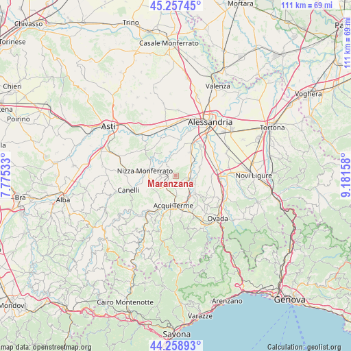
Maranzana GPS coordinates[2]
44° 45' 37.26" North, 8° 28' 42.42" East
| Map corner | latitude | longitude |
|---|---|---|
| Upper-left | 45.25745°, | 7.77533° |
| Center: | 44.76035°, | 8.47845° |
| Lower-right: | 44.25893°, | 9.18158° |
| Map W x H: | 111×111 km | = 69×69mi |
| max Lat: | 47.04031° ⇑44.6% North |
| Maranzana: | 44.76035° |
| min Lat: | ⇓55.4% South 35.50142° |
| min Long | Maranzana | max Long |
| 6.69888° | 8.47845° | 18.48682° |
| W 11.8%⇐ | ⇒88.2% E |
Elevation
Elevation of Maranzana is 266 m = 873 ft, and this is 40.7 m = 134 ft below average elevation for this country.
| Max E: |
2085 m = 6841 ft | 44.9% |
| Avg. | 306.7 m = 1006 ft | |
| Maranzana | 266 m = 873 ft | |
Min E: |
-4 m = -13 ft | 55.1% |
See also: Italy elevation on elevation.city.
Geographical zone
Maranzana is located in North temperate zone (between Tropic of Cancer and the Arctic Circle). Distance of this Northern Tropic circle is 2371 km =1473.3 mi to South.| Distance of | km | miles | from Maranzana |
|---|---|---|---|
| North Pole | 5030.2 | 3125.6 | to North |
| Arctic Circle | 2424.3 | 1506.4 | to North |
| Tropic Cancer | 2371 | 1473.3 | to South |
| Equator | 4976.9 | 3092.5 | to South |


Nearby cities:
15 places around Maranzana: (largest is in red/bold)
• Alice Bel Colle
4.4 km =2.7 mi,  209°
209°
• Bergamasco
7.7 km =4.8 mi,  345°
345°
• Bruno
4.7 km =2.9 mi,  319°
319°
• Carentino
7.6 km =4.7 mi,  355°
355°
• Cassine
4.1 km =2.5 mi,  103°
103°
• Castel Rocchero
6.8 km =4.2 mi,  226°
226°
• Castelletto Molina
3.7 km =2.3 mi,  254°
254°
• Castelnuovo Belbo
6.9 km =4.3 mi,  310°
310°
• Castelnuovo Bormida
6 km =3.7 mi,  109°
109°
• Fontanile
4.6 km =2.9 mi,  259°
259°
• Gamalero
7.3 km =4.5 mi,  42°
42°
• Mombaruzzo
2.7 km =1.7 mi,  297°
297°
• Quaranti
2.5 km =1.6 mi, 245°
• Ricaldone
3.2 km =2 mi,  194°
194°
• Strevi
7.7 km =4.8 mi,  151°
151°
Sources, notices
• [Note1] Compared only with cities in Italy existing in our database
• [Src1] Map data: © OpenStreetMap contributors (CC-BY-SA)
• [Src2] Other city data from geonames.org with taken over terms of usage.
• [Src3] Geographical zone / Annual Mean Temperature by Robert A. Rohde @ Wikipedia
