Castegnero geodata
Castegnero (Veneto) is a populated place; located in Italy in Europe/Rome (GMT+2) time zone. With population of 742 people, there are 8007 cities with bigger population in this country. Compared to other cities in Italy, 71.7% of cities are located further ↓South; 50.4% of cities are located further ←West and 86.1% of cities have higher elevation than Castegnero. Note1


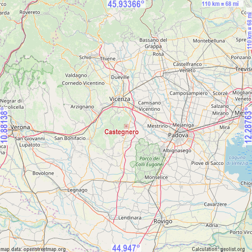
Castegnero GPS coordinates[2]
45° 26' 32.964" North, 11° 35' 4.2" East
| Map corner | latitude | longitude |
|---|---|---|
| Upper-left | 45.93366°, | 10.88138° |
| Center: | 45.44249°, | 11.5845° |
| Lower-right: | 44.947°, | 12.28763° |
| Map W x H: | 109.7×109.7 km | = 68.2×68.2mi |
| max Lat: | 47.04031° ⇑28.3% North |
| Castegnero: | 45.44249° |
| min Lat: | ⇓71.7% South 35.50142° |
| min Long | Castegnero | max Long |
| 6.69888° | 11.5845° | 18.48682° |
| W 50.4%⇐ | ⇒49.6% E |
Elevation
Elevation of Castegnero is 28 m = 92 ft, and this is 278.7 m = 914 ft below average elevation for this country.
| Max E: |
2085 m = 6841 ft | 86.1% |
| Avg. | 306.7 m = 1006 ft | |
| Castegnero | 28 m = 92 ft | |
Min E: |
-4 m = -13 ft | 13.9% |
See also: Italy elevation on elevation.city.
Geographical zone
Castegnero is located in North temperate zone (between Tropic of Cancer and the Arctic Circle). Distance of this North polar circle is 2348.4 km =1459.2 mi to North.| Distance of | km | miles | from Castegnero |
|---|---|---|---|
| North Pole | 4954.3 | 3078.5 | to North |
| Arctic Circle | 2348.4 | 1459.2 | to North |
| Tropic Cancer | 2446.8 | 1520.4 | to South |
| Equator | 5052.7 | 3139.6 | to South |


Nearby cities:
15 places around Castegnero: (largest is in red/bold)
• Arcugnano-Torri
6.6 km =4.1 mi,  334°
334°
• Barbarano Vicentino
4.9 km =3 mi,  220°
220°
• Longare
4.2 km =2.6 mi,  24°
24°
• Lumignano
1.9 km =1.2 mi,  7°
7°
• Montegalda
7.1 km =4.4 mi,  86°
86°
• Montegaldella
6.7 km =4.2 mi,  95°
95°
• Mossano
3.5 km =2.2 mi, 223°
• Pianezze del Lago
4.5 km =2.8 mi,  336°
336°
• Ponte di Barbarano
5.6 km =3.5 mi,  184°
184°
• Ponte di Castegnero
1.4 km =0.9 mi,  116°
116°
• Ponte di Nanto
2.2 km =1.4 mi,  159°
159°
• Secula
5 km =3.1 mi,  30°
30°
• Villaga
5.9 km =3.7 mi, 221°
• Villaganzerla
2.8 km =1.7 mi, 104°
• Zovencedo
6.5 km =4 mi,  256°
256°
Sources, notices
• [Note1] Compared only with cities in Italy existing in our database
• [Src1] Map data: © OpenStreetMap contributors (CC-BY-SA)
• [Src2] Other city data from geonames.org with taken over terms of usage.
• [Src3] Geographical zone / Annual Mean Temperature by Robert A. Rohde @ Wikipedia
