Mossano geodata
Mossano (Veneto) is a seat of a third-order administrative division; located in Italy in Europe/Rome (GMT+2) time zone. With population of 324 people, there are 10576 cities with bigger population in this country. Compared to other cities in Italy, 70.8% of cities are located further ↓South; 50.1% of cities are located further ←West and 75.2% of cities have higher elevation than Mossano. Note1
Administrative division(s):
- Level 1: Veneto
- Level 2: Provincia di Vicenza
- Level 3: Barbarano Mossano


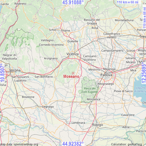
Mossano GPS coordinates[2]
45° 25' 10.236" North, 11° 33' 13.752" East
| Map corner | latitude | longitude |
|---|---|---|
| Upper-left | 45.91088°, | 10.8507° |
| Center: | 45.41951°, | 11.55382° |
| Lower-right: | 44.92382°, | 12.25695° |
| Map W x H: | 109.8×109.7 km | = 68.2×68.2mi |
| max Lat: | 47.04031° ⇑29.2% North |
| Mossano: | 45.41951° |
| min Lat: | ⇓70.8% South 35.50142° |
| min Long | Mossano | max Long |
| 6.69888° | 11.55382° | 18.48682° |
| W 50.1%⇐ | ⇒49.9% E |
Elevation
Elevation of Mossano is 73 m = 240 ft, and this is 233.7 m = 767 ft below average elevation for this country.
| Max E: |
2085 m = 6841 ft | 75.2% |
| Avg. | 306.7 m = 1006 ft | |
| Mossano | 73 m = 240 ft | |
Min E: |
-4 m = -13 ft | 24.8% |
See also: Italy elevation on elevation.city.
Geographical zone
Mossano is located in North temperate zone (between Tropic of Cancer and the Arctic Circle). Distance of this North polar circle is 2351 km =1460.8 mi to North.| Distance of | km | miles | from Mossano |
|---|---|---|---|
| North Pole | 4956.9 | 3080.1 | to North |
| Arctic Circle | 2351 | 1460.8 | to North |
| Tropic Cancer | 2444.3 | 1518.8 | to South |
| Equator | 5050.2 | 3138 | to South |


Nearby cities:
15 places around Mossano: (largest is in red/bold)
• Albettone
7.2 km =4.5 mi,  160°
160°
• Barbarano Vicentino
1.4 km =0.9 mi,  215°
215°
• Castegnero
3.5 km =2.2 mi,  43°
43°
• Longare
7.6 km =4.7 mi,  32°
32°
• Lumignano
5.2 km =3.2 mi, 30°
• Pederiva
6.9 km =4.3 mi,  272°
272°
• Pianezze del Lago
6.7 km =4.2 mi,  5°
5°
• Ponte di Barbarano
3.6 km =2.2 mi,  147°
147°
• Ponte di Castegnero
4.1 km =2.5 mi,  62°
62°
• Ponte di Nanto
3.2 km =2 mi,  80°
80°
• San Germano dei Berici
6.7 km =4.2 mi,  252°
252°
• Sossano
7.8 km =4.8 mi,  207°
207°
• Villaga
2.4 km =1.5 mi, 218°
• Villaganzerla
5.4 km =3.4 mi,  69°
69°
• Zovencedo
4 km =2.5 mi,  285°
285°
Sources, notices
• [Note1] Compared only with cities in Italy existing in our database
• [Src1] Map data: © OpenStreetMap contributors (CC-BY-SA)
• [Src2] Other city data from geonames.org with taken over terms of usage.
• [Src3] Geographical zone / Annual Mean Temperature by Robert A. Rohde @ Wikipedia
