Ultimo - Ulten geodata
Ultimo - Ulten (Trentino-Alto Adige) is a seat of a third-order administrative division; located in Italy in Europe/Rome (GMT+2) time zone. With population of 3,006 people, there are 3037 cities with bigger population in this country. Compared to other cities in Italy, 98.6% of cities are located further ↓South; 57.3% of cities are located further →East and 98.1% of cities have lower elevation than Ultimo - Ulten. Note1


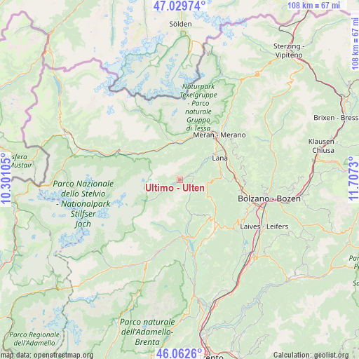
Ultimo - Ulten GPS coordinates[2]
46° 32' 53.952" North, 11° 0' 15.012" East
| Map corner | latitude | longitude |
|---|---|---|
| Upper-left | 47.02974°, | 10.30105° |
| Center: | 46.54832°, | 11.00417° |
| Lower-right: | 46.0626°, | 11.7073° |
| Map W x H: | 107.5×107.5 km | = 66.8×66.8mi |
| max Lat: | 47.04031° ⇑1.4% North |
| Ultimo - Ulten: | 46.54832° |
| min Lat: | ⇓98.6% South 35.50142° |
| min Long | Ultimo - Ulten | max Long |
| 6.69888° | 11.00417° | 18.48682° |
| W 42.7%⇐ | ⇒57.3% E |
Elevation
Elevation of Ultimo - Ulten is 1118 m = 3668 ft, and this is 811.3 m = 2662 ft above average elevation for this country.
| Max E: |
2085 m = 6841 ft | 1.9% |
| Ultimo - Ulten | 1118 m 3668 ft | |
| Avg. | 306.7 m = 1006 ft | |
Min E: |
-4 m = -13 ft | 98.1% |
See also: Italy elevation on elevation.city.
Geographical zone
Ultimo - Ulten is located in North temperate zone (between Tropic of Cancer and the Arctic Circle). Distance of this North polar circle is 2225.5 km =1382.9 mi to North.| Distance of | km | miles | from Ultimo - Ulten |
|---|---|---|---|
| North Pole | 4831.4 | 3002.1 | to North |
| Arctic Circle | 2225.5 | 1382.9 | to North |
| Tropic Cancer | 2569.8 | 1596.8 | to South |
| Equator | 5175.7 | 3216 | to South |


Nearby cities:
15 places around Ultimo - Ulten: (largest is in red/bold)
• Castelbello
11.6 km =7.2 mi,  320°
320°
• Castelbello-Ciardes - Kastelbell-Tschars
11.6 km =7.2 mi, 320°
• Ciardes
11.1 km =6.9 mi,  334°
334°
• Foiana
12 km =7.5 mi,  65°
65°
• Lauregno
11.3 km =7 mi,  157°
157°
• Naturno
11.1 km =6.9 mi,  358°
358°
• Plaus
12.3 km =7.6 mi,  13°
13°
• Proves - Proveis
8.1 km =5 mi,  170°
170°
• Rumo
11.9 km =7.4 mi, 174°
• San Felice
11.4 km =7.1 mi,  121°
121°
• San Pancrazio
7.5 km =4.7 mi,  56°
56°
• Santa Valburga
0.4 km =0.2 mi,  300°
300°
• Senale
9.1 km =5.7 mi, 117°
• Tarres
11.8 km =7.3 mi, 303°
• Tesimo
12.8 km =8 mi,  81°
81°
Sources, notices
• [Note1] Compared only with cities in Italy existing in our database
• [Src1] Map data: © OpenStreetMap contributors (CC-BY-SA)
• [Src2] Other city data from geonames.org with taken over terms of usage.
• [Src3] Geographical zone / Annual Mean Temperature by Robert A. Rohde @ Wikipedia
