Daverio geodata
Daverio (Lombardy) is a seat of a third-order administrative division; located in Italy in Europe/Rome (GMT+2) time zone. With population of 2,989 people, there are 3052 cities with bigger population in this country. Compared to other cities in Italy, 84.8% of cities are located further ↓South; 84.4% of cities are located further →East and 63.7% of cities have lower elevation than Daverio. Note1


Daverio GPS coordinates[2]
45° 46' 40.692" North, 8° 46' 24.348" East
| Map corner | latitude | longitude |
|---|---|---|
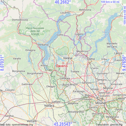
| Upper-left | 46.2662°, | 8.07031° |
| Center: | 45.77797°, | 8.77343° |
| Lower-right: | 45.28543°, | 9.47656° |
| Map W x H: | 109.1×109.1 km | = 67.8×67.8mi |
| max Lat: | 47.04031° ⇑15.2% North |
| Daverio: | 45.77797° |
| min Lat: | ⇓84.8% South 35.50142° |
| min Long | Daverio | max Long |
| 6.69888° | 8.77343° | 18.48682° |
| W 15.6%⇐ | ⇒84.4% E |
Elevation
Elevation of Daverio is 330 m = 1083 ft, and this is 23.3 m = 76 ft above average elevation for this country.
| Max E: |
2085 m = 6841 ft | 36.3% |
| Daverio | 330 m 1083 ft | |
| Avg. | 306.7 m = 1006 ft | |
Min E: |
-4 m = -13 ft | 63.7% |
See also: Italy elevation on elevation.city.
Geographical zone
Daverio is located in North temperate zone (between Tropic of Cancer and the Arctic Circle). Distance of this North polar circle is 2311.1 km =1436.1 mi to North.| Distance of | km | miles | from Daverio |
|---|---|---|---|
| North Pole | 4917 | 3055.3 | to North |
| Arctic Circle | 2311.1 | 1436.1 | to North |
| Tropic Cancer | 2484.1 | 1543.5 | to South |
| Equator | 5090 | 3162.8 | to South |


Nearby cities:
15 places around Daverio: (largest is in red/bold)
• Azzate
1.6 km =1 mi,  89°
89°
• Bodio
2.2 km =1.4 mi,  307°
307°
• Bodio Lomnago
2.1 km =1.3 mi,  304°
304°
• Brunello
2.2 km =1.4 mi,  130°
130°
• Buguggiate
2.9 km =1.8 mi,  80°
80°
• Calcinate del Pesce
4.3 km =2.7 mi,  349°
349°
• Capolago
3.3 km =2.1 mi,  58°
58°
• Casale Litta
2.7 km =1.7 mi,  245°
245°
• Cascine Maggio
3.6 km =2.2 mi,  124°
124°
• Cazzago Brabbia
3.6 km =2.2 mi, 303°
• Crosio della Valle
2 km =1.2 mi,  186°
186°
• Galliate Lombardo
0.8 km =0.5 mi,  343°
343°
• Inarzo
3.1 km =1.9 mi,  286°
286°
• Montonate
3.4 km =2.1 mi,  180°
180°
• Mornago
4.1 km =2.5 mi,  206°
206°
Sources, notices
• [Note1] Compared only with cities in Italy existing in our database
• [Src1] Map data: © OpenStreetMap contributors (CC-BY-SA)
• [Src2] Other city data from geonames.org with taken over terms of usage.
• [Src3] Geographical zone / Annual Mean Temperature by Robert A. Rohde @ Wikipedia
