Vervio geodata
Vervio (Lombardy) is a seat of a third-order administrative division; located in Italy in Europe/Rome (GMT+2) time zone. With population of 99 people, there are 11443 cities with bigger population in this country. Compared to other cities in Italy, 96.4% of cities are located further ↓South; 65.6% of cities are located further →East and 81.1% of cities have lower elevation than Vervio. Note1


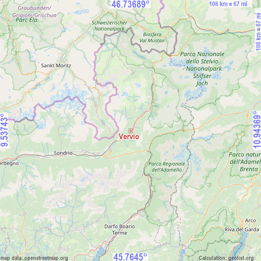
Vervio GPS coordinates[2]
46° 15' 10.26" North, 10° 14' 26.016" East
| Map corner | latitude | longitude |
|---|---|---|
| Upper-left | 46.73689°, | 9.53743° |
| Center: | 46.25285°, | 10.24056° |
| Lower-right: | 45.7645°, | 10.94369° |
| Map W x H: | 108.1×108.1 km | = 67.2×67.2mi |
| max Lat: | 47.04031° ⇑3.6% North |
| Vervio: | 46.25285° |
| min Lat: | ⇓96.4% South 35.50142° |
| min Long | Vervio | max Long |
| 6.69888° | 10.24056° | 18.48682° |
| W 34.4%⇐ | ⇒65.6% E |
Elevation
Elevation of Vervio is 541 m = 1775 ft, and this is 234.3 m = 769 ft above average elevation for this country.
| Max E: |
2085 m = 6841 ft | 18.9% |
| Vervio | 541 m 1775 ft | |
| Avg. | 306.7 m = 1006 ft | |
Min E: |
-4 m = -13 ft | 81.1% |
See also: Italy elevation on elevation.city.
Geographical zone
Vervio is located in North temperate zone (between Tropic of Cancer and the Arctic Circle). Distance of this North polar circle is 2258.3 km =1403.2 mi to North.| Distance of | km | miles | from Vervio |
|---|---|---|---|
| North Pole | 4864.2 | 3022.5 | to North |
| Arctic Circle | 2258.3 | 1403.2 | to North |
| Tropic Cancer | 2536.9 | 1576.4 | to South |
| Equator | 5142.8 | 3195.6 | to South |


Nearby cities:
15 places around Vervio: (largest is in red/bold)
• Bianzone
12.5 km =7.8 mi,  233°
233°
• Corteno Golgi
9.6 km =6 mi,  178°
178°
• Edolo
11 km =6.8 mi,  139°
139°
• Grosio
5.9 km =3.7 mi,  27°
27°
• Grosotto
3.5 km =2.2 mi,  23°
23°
• Incudine
9.8 km =6.1 mi,  111°
111°
• Lovero
2.6 km =1.6 mi,  201°
201°
• Mazzo di Valtellina
1.2 km =0.7 mi,  66°
66°
• Monno
8.9 km =5.5 mi,  120°
120°
• Sernio
4.2 km =2.6 mi,  220°
220°
• Sondalo
10.8 km =6.7 mi,  37°
37°
• Tirano
7.3 km =4.5 mi, 234°
• Tovo di Sant'Agata
1 km =0.6 mi,  151°
151°
• Vezza d'Oglio
12.2 km =7.6 mi,  97°
97°
• Villa
9.8 km =6.1 mi,  236°
236°
Sources, notices
• [Note1] Compared only with cities in Italy existing in our database
• [Src1] Map data: © OpenStreetMap contributors (CC-BY-SA)
• [Src2] Other city data from geonames.org with taken over terms of usage.
• [Src3] Geographical zone / Annual Mean Temperature by Robert A. Rohde @ Wikipedia
