Villa geodata
Villa (Lombardy) is a seat of a third-order administrative division; located in Italy in Europe/Rome (GMT+2) time zone. With population of 2,194 people, there are 3880 cities with bigger population in this country. Compared to other cities in Italy, 96% of cities are located further ↓South; 66.5% of cities are located further →East and 71.1% of cities have lower elevation than Villa. Note1
Administrative division(s):
- Level 1: Lombardy
- Level 2: Provincia di Sondrio
- Level 3: Villa di Tirano


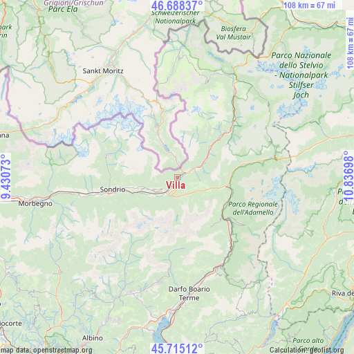
Villa GPS coordinates[2]
46° 12' 14.04" North, 10° 8' 1.86" East
| Map corner | latitude | longitude |
|---|---|---|
| Upper-left | 46.68837°, | 9.43073° |
| Center: | 46.2039°, | 10.13385° |
| Lower-right: | 45.71512°, | 10.83698° |
| Map W x H: | 108.2×108.2 km | = 67.2×67.2mi |
| max Lat: | 47.04031° ⇑4% North |
| Villa: | 46.2039° |
| min Lat: | ⇓96% South 35.50142° |
| min Long | Villa | max Long |
| 6.69888° | 10.13385° | 18.48682° |
| W 33.5%⇐ | ⇒66.5% E |
Elevation
Elevation of Villa is 405 m = 1329 ft, and this is 98.3 m = 323 ft above average elevation for this country.
| Max E: |
2085 m = 6841 ft | 28.9% |
| Villa | 405 m 1329 ft | |
| Avg. | 306.7 m = 1006 ft | |
Min E: |
-4 m = -13 ft | 71.1% |
See also: Italy elevation on elevation.city.
Geographical zone
Villa is located in North temperate zone (between Tropic of Cancer and the Arctic Circle). Distance of this North polar circle is 2263.8 km =1406.7 mi to North.| Distance of | km | miles | from Villa |
|---|---|---|---|
| North Pole | 4869.7 | 3025.9 | to North |
| Arctic Circle | 2263.8 | 1406.7 | to North |
| Tropic Cancer | 2531.5 | 1573 | to South |
| Equator | 5137.4 | 3192.2 | to South |


Nearby cities:
15 places around Villa: (largest is in red/bold)
• Aprica
5.9 km =3.7 mi,  168°
168°
• Bianzone
2.7 km =1.7 mi,  224°
224°
• Castello dell'Acqua
11.2 km =7 mi,  234°
234°
• Castionetto
10.4 km =6.5 mi,  252°
252°
• Chiuro
12.1 km =7.5 mi, 250°
• Corteno Golgi
9.4 km =5.8 mi,  116°
116°
• Lovero
7.9 km =4.9 mi,  67°
67°
• Mazzo di Valtellina
11.1 km =6.9 mi,  57°
57°
• San Giacomo
9.7 km =6 mi,  239°
239°
• Sernio
5.9 km =3.7 mi, 67°
• Teglio
6.4 km =4 mi, 236°
• Tirano
2.6 km =1.6 mi, 61°
• Tovo di Sant'Agata
9.8 km =6.1 mi, 62°
• Tresenda
6.3 km =3.9 mi, 221°
• Vervio
9.8 km =6.1 mi, 56°
Sources, notices
• [Note1] Compared only with cities in Italy existing in our database
• [Src1] Map data: © OpenStreetMap contributors (CC-BY-SA)
• [Src2] Other city data from geonames.org with taken over terms of usage.
• [Src3] Geographical zone / Annual Mean Temperature by Robert A. Rohde @ Wikipedia
