Lovero geodata
Lovero (Lombardy) is a seat of a third-order administrative division; located in Italy in Europe/Rome (GMT+2) time zone. With population of 638 people, there are 8721 cities with bigger population in this country. Compared to other cities in Italy, 96.3% of cities are located further ↓South; 65.7% of cities are located further →East and 79.1% of cities have lower elevation than Lovero. Note1


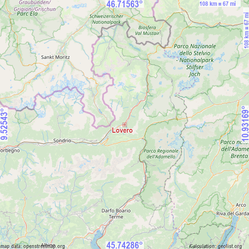
Lovero GPS coordinates[2]
46° 13' 53.04" North, 10° 13' 42.816" East
| Map corner | latitude | longitude |
|---|---|---|
| Upper-left | 46.71563°, | 9.52543° |
| Center: | 46.2314°, | 10.22856° |
| Lower-right: | 45.74286°, | 10.93169° |
| Map W x H: | 108.2×108.2 km | = 67.2×67.2mi |
| max Lat: | 47.04031° ⇑3.7% North |
| Lovero: | 46.2314° |
| min Lat: | ⇓96.3% South 35.50142° |
| min Long | Lovero | max Long |
| 6.69888° | 10.22856° | 18.48682° |
| W 34.3%⇐ | ⇒65.7% E |
Elevation
Elevation of Lovero is 509 m = 1670 ft, and this is 202.3 m = 664 ft above average elevation for this country.
| Max E: |
2085 m = 6841 ft | 20.9% |
| Lovero | 509 m 1670 ft | |
| Avg. | 306.7 m = 1006 ft | |
Min E: |
-4 m = -13 ft | 79.1% |
See also: Italy elevation on elevation.city.
Geographical zone
Lovero is located in North temperate zone (between Tropic of Cancer and the Arctic Circle). Distance of this North polar circle is 2260.7 km =1404.7 mi to North.| Distance of | km | miles | from Lovero |
|---|---|---|---|
| North Pole | 4866.6 | 3024 | to North |
| Arctic Circle | 2260.7 | 1404.7 | to North |
| Tropic Cancer | 2534.5 | 1574.9 | to South |
| Equator | 5140.4 | 3194.1 | to South |


Nearby cities:
15 places around Lovero: (largest is in red/bold)
• Aprica
10.7 km =6.6 mi,  214°
214°
• Bianzone
10.4 km =6.5 mi,  241°
241°
• Corteno Golgi
7.3 km =4.5 mi,  171°
171°
• Edolo
10 km =6.2 mi,  126°
126°
• Grosio
8.4 km =5.2 mi,  25°
25°
• Grosotto
6.1 km =3.8 mi,  22°
22°
• Incudine
10.1 km =6.3 mi,  97°
97°
• Mazzo di Valtellina
3.5 km =2.2 mi,  35°
35°
• Monno
8.8 km =5.5 mi, 103°
• Sernio
2 km =1.2 mi,  245°
245°
• Sonico
11.9 km =7.4 mi, 127°
• Tirano
5.3 km =3.3 mi, 249°
• Tovo di Sant'Agata
2.1 km =1.3 mi, 42°
• Vervio
2.6 km =1.6 mi, 21°
• Villa
7.9 km =4.9 mi, 247°
Sources, notices
• [Note1] Compared only with cities in Italy existing in our database
• [Src1] Map data: © OpenStreetMap contributors (CC-BY-SA)
• [Src2] Other city data from geonames.org with taken over terms of usage.
• [Src3] Geographical zone / Annual Mean Temperature by Robert A. Rohde @ Wikipedia
