Songavazzo geodata
Songavazzo (Lombardy) is a seat of a third-order administrative division; located in Italy in Europe/Rome (GMT+2) time zone. With population of 668 people, there are 8500 cities with bigger population in this country. Compared to other cities in Italy, 88.6% of cities are located further ↓South; 67.9% of cities are located further →East and 86.5% of cities have lower elevation than Songavazzo. Note1


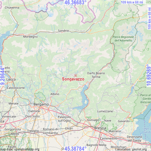
Songavazzo GPS coordinates[2]
45° 52' 46.164" North, 9° 59' 22.416" East
| Map corner | latitude | longitude |
|---|---|---|
| Upper-left | 46.36683°, | 9.28644° |
| Center: | 45.87949°, | 9.98956° |
| Lower-right: | 45.38784°, | 10.69269° |
| Map W x H: | 108.9×108.9 km | = 67.7×67.7mi |
| max Lat: | 47.04031° ⇑11.4% North |
| Songavazzo: | 45.87949° |
| min Lat: | ⇓88.6% South 35.50142° |
| min Long | Songavazzo | max Long |
| 6.69888° | 9.98956° | 18.48682° |
| W 32.1%⇐ | ⇒67.9% E |
Elevation
Elevation of Songavazzo is 643 m = 2110 ft, and this is 336.3 m = 1103 ft above average elevation for this country.
| Max E: |
2085 m = 6841 ft | 13.5% |
| Songavazzo | 643 m 2110 ft | |
| Avg. | 306.7 m = 1006 ft | |
Min E: |
-4 m = -13 ft | 86.5% |
See also: Italy elevation on elevation.city.
Geographical zone
Songavazzo is located in North temperate zone (between Tropic of Cancer and the Arctic Circle). Distance of this North polar circle is 2299.9 km =1429.1 mi to North.| Distance of | km | miles | from Songavazzo |
|---|---|---|---|
| North Pole | 4905.7 | 3048.3 | to North |
| Arctic Circle | 2299.9 | 1429.1 | to North |
| Tropic Cancer | 2495.4 | 1550.6 | to South |
| Equator | 5101.3 | 3169.8 | to South |


Nearby cities:
15 places around Songavazzo: (largest is in red/bold)
• Ardesio
7.8 km =4.8 mi,  323°
323°
• Bossico
7.1 km =4.4 mi,  142°
142°
• Castione della Presolana
6.4 km =4 mi,  52°
52°
• Cerete Alto
1.4 km =0.9 mi,  163°
163°
• Cerete Basso
2.2 km =1.4 mi,  172°
172°
• Clusone
3.4 km =2.1 mi,  283°
283°
• Fino del Monte
1.5 km =0.9 mi,  13°
13°
• Oltressenda Alta
5.3 km =3.3 mi, 318°
• Onore
2.1 km =1.3 mi, 50°
• Parre
7.7 km =4.8 mi,  265°
265°
• Piario
5.2 km =3.2 mi,  291°
291°
• Rovetta
1.5 km =0.9 mi,  337°
337°
• San Lorenzo di Rovetta
1.1 km =0.7 mi, 271°
• Sovere
8.3 km =5.2 mi, 155°
• Villa d'Ogna
5.3 km =3.3 mi,  301°
301°
Sources, notices
• [Note1] Compared only with cities in Italy existing in our database
• [Src1] Map data: © OpenStreetMap contributors (CC-BY-SA)
• [Src2] Other city data from geonames.org with taken over terms of usage.
• [Src3] Geographical zone / Annual Mean Temperature by Robert A. Rohde @ Wikipedia
