San Lorenzo di Rovetta geodata
San Lorenzo di Rovetta (Lombardy) is a populated place; located in Italy in Europe/Rome (GMT+2) time zone. With population of 1,381 people, there are 5405 cities with bigger population in this country. Compared to other cities in Italy, 88.6% of cities are located further ↓South; 68.1% of cities are located further →East and 85.4% of cities have lower elevation than San Lorenzo di Rovetta. Note1
Current local time in San Lorenzo di Rovetta:
09:32 PM, WednesdayDifference from your time zone: hours


San Lorenzo di Rovetta GPS coordinates[2]
45° 52' 46.956" North, 9° 58' 31.332" East
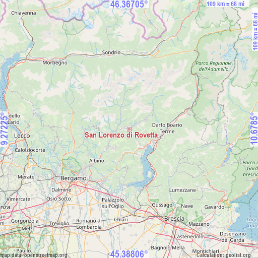
| Map corner | latitude | longitude |
|---|---|---|
| Upper-left | 46.36705°, | 9.27225° |
| Center: | 45.87971°, | 9.97537° |
| Lower-right: | 45.38806°, | 10.6785° |
| Map W x H: | 108.9×108.9 km | = 67.7×67.7mi |
| max Lat: | 47.04031° ⇑11.4% North |
| San Lorenzo di Rovetta: | 45.87971° |
| min Lat: | ⇓88.6% South 35.50142° |
| min Long | San Lorenzo di | max Long |
| 6.69888° | 9.97537° | 18.48682° |
| W 31.9%⇐ | ⇒68.1% E |
Elevation
Elevation of San Lorenzo di Rovetta is 620 m = 2034 ft, and this is 313.3 m = 1028 ft above average elevation for this country.
| Max E: |
2085 m = 6841 ft | 14.6% |
| San Lorenzo di Rovetta | 620 m 2034 ft | |
| Avg. | 306.7 m = 1006 ft | |
Min E: |
-4 m = -13 ft | 85.4% |
See also: Italy elevation on elevation.city.
Geographical zone
San Lorenzo di Rovetta is located in North temperate zone (between Tropic of Cancer and the Arctic Circle). Distance of this North polar circle is 2299.8 km =1429 mi to North.| Distance of | km | miles | from San Lorenzo di Rovetta |
|---|---|---|---|
| North Pole | 4905.7 | 3048.3 | to North |
| Arctic Circle | 2299.8 | 1429 | to North |
| Tropic Cancer | 2495.4 | 1550.6 | to South |
| Equator | 5101.3 | 3169.8 | to South |


Nearby cities:
15 places around San Lorenzo di Rovetta: (largest is in red/bold)
• Ardesio
7.2 km =4.5 mi,  330°
330°
• Bossico
7.9 km =4.9 mi,  136°
136°
• Castione della Presolana
7.3 km =4.5 mi,  57°
57°
• Cerete Alto
2 km =1.2 mi,  132°
132°
• Cerete Basso
2.6 km =1.6 mi,  147°
147°
• Clusone
2.4 km =1.5 mi,  288°
288°
• Fino del Monte
2 km =1.2 mi,  45°
45°
• Oltressenda Alta
4.6 km =2.9 mi, 329°
• Onore
3 km =1.9 mi, 64°
• Parre
6.6 km =4.1 mi,  265°
265°
• Piario
4.2 km =2.6 mi,  296°
296°
• Ponte Nossa
7.3 km =4.5 mi,  257°
257°
• Rovetta
1.4 km =0.9 mi,  21°
21°
• Songavazzo
1.1 km =0.7 mi,  91°
91°
• Villa d'Ogna
4.4 km =2.7 mi,  308°
308°
Sources, notices
• [Note1] Compared only with cities in Italy existing in our database
• [Src1] Map data: © OpenStreetMap contributors (CC-BY-SA)
• [Src2] Other city data from geonames.org with taken over terms of usage.
• [Src3] Geographical zone / Annual Mean Temperature by Robert A. Rohde @ Wikipedia
