Villanova del Sillaro geodata
Villanova del Sillaro (Lombardy) is a seat of a third-order administrative division; located in Italy in Europe/Rome (GMT+2) time zone. With population of 459 people, there are 10052 cities with bigger population in this country. Compared to other cities in Italy, 65.9% of cities are located further ↓South; 73.5% of cities are located further →East and 75.9% of cities have higher elevation than Villanova del Sillaro. Note1
Administrative division(s):
- Level 1: Lombardy
- Level 2: Provincia di Lodi
- Level 3: Villanova del Sillaro
Current local time in Villanova del Sillaro:
10:11 PM, WednesdayDifference from your time zone: hours


Villanova del Sillaro GPS coordinates[2]
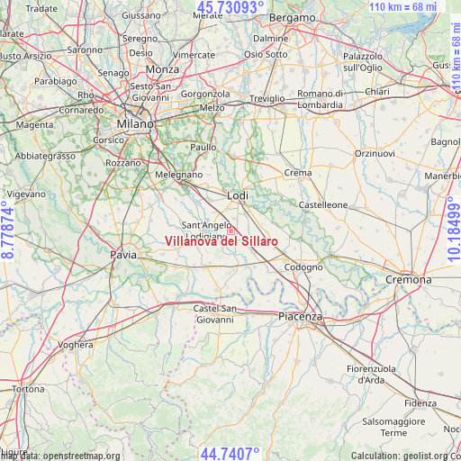
45° 14' 16.692" North, 9° 28' 54.696" East
| Map corner | latitude | longitude |
|---|---|---|
| Upper-left | 45.73093°, | 8.77874° |
| Center: | 45.23797°, | 9.48186° |
| Lower-right: | 44.7407°, | 10.18499° |
| Map W x H: | 110.1×110.1 km | = 68.4×68.4mi |
| max Lat: | 47.04031° ⇑34.1% North |
| Villanova del Sillaro: | 45.23797° |
| min Lat: | ⇓65.9% South 35.50142° |
| min Long | Villanova del S | max Long |
| 6.69888° | 9.48186° | 18.48682° |
| W 26.5%⇐ | ⇒73.5% E |
Elevation
Elevation of Villanova del Sillaro is 70 m = 230 ft, and this is 236.7 m = 777 ft below average elevation for this country.
| Max E: |
2085 m = 6841 ft | 75.9% |
| Avg. | 306.7 m = 1006 ft | |
| Villanova del Sillaro | 70 m = 230 ft | |
Min E: |
-4 m = -13 ft | 24.1% |
See also: Italy elevation on elevation.city.
Geographical zone
Villanova del Sillaro is located in North temperate zone (between Tropic of Cancer and the Arctic Circle). Distance of this North polar circle is 2371.2 km =1473.4 mi to North.| Distance of | km | miles | from Villanova del Sillaro |
|---|---|---|---|
| North Pole | 4977.1 | 3092.6 | to North |
| Arctic Circle | 2371.2 | 1473.4 | to North |
| Tropic Cancer | 2424.1 | 1506.3 | to South |
| Equator | 5030 | 3125.5 | to South |


Nearby cities:
15 places around Villanova del Sillaro: (largest is in red/bold)
• Bargano
2.8 km =1.7 mi,  275°
275°
• Borghetto Lodigiano
3.1 km =1.9 mi,  153°
153°
• Borgo San Giovanni
5.8 km =3.6 mi,  320°
320°
• Castiraga Vidardo
6.4 km =4 mi,  289°
289°
• Graffignana
4.1 km =2.5 mi,  211°
211°
• Livraga
7.2 km =4.5 mi,  135°
135°
• Massalengo-Motta Vigana
3.1 km =1.9 mi,  12°
12°
• Monteleone
7.5 km =4.7 mi,  229°
229°
• Muzza di Cornegliano Laudense
5.2 km =3.2 mi,  351°
351°
• Ossago Lodigiano
4.4 km =2.7 mi,  83°
83°
• Pieve Fissiraga
3.4 km =2.1 mi,  326°
326°
• San Colombano al Lambro
6.1 km =3.8 mi,  173°
173°
• San Martino in Strada
5.4 km =3.4 mi,  40°
40°
• Sant'Angelo Lodigiano
5.9 km =3.7 mi,  267°
267°
• Vidardo
6.6 km =4.1 mi, 288°
Sources, notices
• [Note1] Compared only with cities in Italy existing in our database
• [Src1] Map data: © OpenStreetMap contributors (CC-BY-SA)
• [Src2] Other city data from geonames.org with taken over terms of usage.
• [Src3] Geographical zone / Annual Mean Temperature by Robert A. Rohde @ Wikipedia
