Livraga geodata
Livraga (Lombardy) is a seat of a third-order administrative division; located in Italy in Europe/Rome (GMT+2) time zone. With population of 2,126 people, there are 3955 cities with bigger population in this country. Compared to other cities in Italy, 64.8% of cities are located further ↓South; 72.7% of cities are located further →East and 77.7% of cities have higher elevation than Livraga. Note1


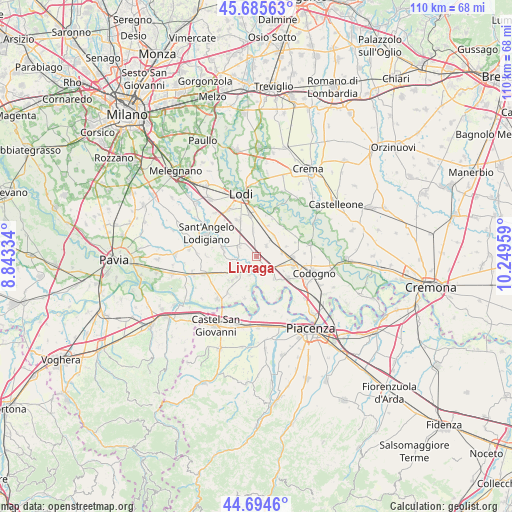
Livraga GPS coordinates[2]
45° 11' 32.172" North, 9° 32' 47.256" East
| Map corner | latitude | longitude |
|---|---|---|
| Upper-left | 45.68563°, | 8.84334° |
| Center: | 45.19227°, | 9.54646° |
| Lower-right: | 44.6946°, | 10.24959° |
| Map W x H: | 110.2×110.2 km | = 68.5×68.5mi |
| max Lat: | 47.04031° ⇑35.2% North |
| Livraga: | 45.19227° |
| min Lat: | ⇓64.8% South 35.50142° |
| min Long | Livraga | max Long |
| 6.69888° | 9.54646° | 18.48682° |
| W 27.3%⇐ | ⇒72.7% E |
Elevation
Elevation of Livraga is 61 m = 200 ft, and this is 245.7 m = 806 ft below average elevation for this country.
| Max E: |
2085 m = 6841 ft | 77.7% |
| Avg. | 306.7 m = 1006 ft | |
| Livraga | 61 m = 200 ft | |
Min E: |
-4 m = -13 ft | 22.3% |
See also: Italy elevation on elevation.city.
Geographical zone
Livraga is located in North temperate zone (between Tropic of Cancer and the Arctic Circle). Distance of this North polar circle is 2376.3 km =1476.6 mi to North.| Distance of | km | miles | from Livraga |
|---|---|---|---|
| North Pole | 4982.2 | 3095.8 | to North |
| Arctic Circle | 2376.3 | 1476.6 | to North |
| Tropic Cancer | 2419 | 1503.1 | to South |
| Equator | 5024.9 | 3122.3 | to South |


Nearby cities:
15 places around Livraga: (largest is in red/bold)
• Borghetto Lodigiano
4.4 km =2.7 mi,  302°
302°
• Brembio
3 km =1.9 mi,  42°
42°
• Camporinaldo
6.8 km =4.2 mi,  242°
242°
• Chignolo Po
7.1 km =4.4 mi,  226°
226°
• Lambrinia
4.1 km =2.5 mi,  201°
201°
• Mairago
7.1 km =4.4 mi,  20°
20°
• Mirabello
7.1 km =4.4 mi,  131°
131°
• Orio Litta
3.4 km =2.1 mi,  169°
169°
• Ospedaletto Lodigiano
3.6 km =2.2 mi,  135°
135°
• Ossago Lodigiano
5.6 km =3.5 mi,  352°
352°
• San Colombano al Lambro
4.5 km =2.8 mi,  257°
257°
• San Martino Pizzolano
6.7 km =4.2 mi,  118°
118°
• Secugnago
5.7 km =3.5 mi, 40°
• Senna Lodigiana
6 km =3.7 mi, 141°
• Zorlesco
5.5 km =3.4 mi,  80°
80°
Sources, notices
• [Note1] Compared only with cities in Italy existing in our database
• [Src1] Map data: © OpenStreetMap contributors (CC-BY-SA)
• [Src2] Other city data from geonames.org with taken over terms of usage.
• [Src3] Geographical zone / Annual Mean Temperature by Robert A. Rohde @ Wikipedia
