Bargano geodata
Bargano (Lombardy) is a populated place; located in Italy in Europe/Rome (GMT+2) time zone. With population of 1,087 people, there are 6342 cities with bigger population in this country. Compared to other cities in Italy, 65.9% of cities are located further ↓South; 73.9% of cities are located further →East and 75.6% of cities have higher elevation than Bargano. Note1
Administrative division(s):
- Level 1: Lombardy
- Level 2: Provincia di Lodi
- Level 3: Villanova del Sillaro


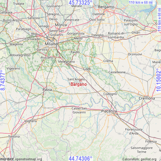
Bargano GPS coordinates[2]
45° 14' 25.116" North, 9° 26' 48.804" East
| Map corner | latitude | longitude |
|---|---|---|
| Upper-left | 45.73325°, | 8.74377° |
| Center: | 45.24031°, | 9.44689° |
| Lower-right: | 44.74306°, | 10.15002° |
| Map W x H: | 110.1×110.1 km | = 68.4×68.4mi |
| max Lat: | 47.04031° ⇑34.1% North |
| Bargano: | 45.24031° |
| min Lat: | ⇓65.9% South 35.50142° |
| min Long | Bargano | max Long |
| 6.69888° | 9.44689° | 18.48682° |
| W 26.1%⇐ | ⇒73.9% E |
Elevation
Elevation of Bargano is 71 m = 233 ft, and this is 235.7 m = 773 ft below average elevation for this country.
| Max E: |
2085 m = 6841 ft | 75.6% |
| Avg. | 306.7 m = 1006 ft | |
| Bargano | 71 m = 233 ft | |
Min E: |
-4 m = -13 ft | 24.4% |
See also: Italy elevation on elevation.city.
Geographical zone
Bargano is located in North temperate zone (between Tropic of Cancer and the Arctic Circle). Distance of this North polar circle is 2370.9 km =1473.2 mi to North.| Distance of | km | miles | from Bargano |
|---|---|---|---|
| North Pole | 4976.8 | 3092.4 | to North |
| Arctic Circle | 2370.9 | 1473.2 | to North |
| Tropic Cancer | 2424.3 | 1506.4 | to South |
| Equator | 5030.3 | 3125.7 | to South |


Nearby cities:
15 places around Bargano: (largest is in red/bold)
• Borghetto Lodigiano
5.1 km =3.2 mi,  126°
126°
• Borgo San Giovanni
4.3 km =2.7 mi,  347°
347°
• Calvenzano
6.2 km =3.9 mi,  301°
301°
• Castiraga Vidardo
3.8 km =2.4 mi, 299°
• Graffignana
3.8 km =2.4 mi,  171°
171°
• Inverno
6.7 km =4.2 mi,  226°
226°
• Inverno e Monteleone
6.8 km =4.2 mi, 225°
• Marudo
5.6 km =3.5 mi,  284°
284°
• Massalengo-Motta Vigana
4.4 km =2.7 mi,  51°
51°
• Monteleone
6 km =3.7 mi,  210°
210°
• Muzza di Cornegliano Laudense
5.3 km =3.3 mi,  21°
21°
• Pieve Fissiraga
2.7 km =1.7 mi, 19°
• Sant'Angelo Lodigiano
3.2 km =2 mi,  259°
259°
• Vidardo
3.9 km =2.4 mi, 297°
• Villanova del Sillaro
2.8 km =1.7 mi,  95°
95°
Sources, notices
• [Note1] Compared only with cities in Italy existing in our database
• [Src1] Map data: © OpenStreetMap contributors (CC-BY-SA)
• [Src2] Other city data from geonames.org with taken over terms of usage.
• [Src3] Geographical zone / Annual Mean Temperature by Robert A. Rohde @ Wikipedia
