Cigognola geodata
Cigognola (Lombardy) is a seat of a third-order administrative division; located in Italy in Europe/Rome (GMT+2) time zone. With population of 213 people, there are 11065 cities with bigger population in this country. Compared to other cities in Italy, 60.7% of cities are located further ↓South; 77.4% of cities are located further →East and 56.4% of cities have lower elevation than Cigognola. Note1


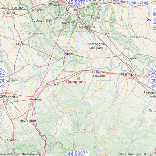
Cigognola GPS coordinates[2]
45° 1' 57.936" North, 9° 14' 41.496" East
| Map corner | latitude | longitude |
|---|---|---|
| Upper-left | 45.5275°, | 8.54173° |
| Center: | 45.03276°, | 9.24486° |
| Lower-right: | 44.5337°, | 9.94798° |
| Map W x H: | 110.5×110.5 km | = 68.7×68.7mi |
| max Lat: | 47.04031° ⇑39.3% North |
| Cigognola: | 45.03276° |
| min Lat: | ⇓60.7% South 35.50142° |
| min Long | Cigognola | max Long |
| 6.69888° | 9.24486° | 18.48682° |
| W 22.6%⇐ | ⇒77.4% E |
Elevation
Elevation of Cigognola is 274 m = 899 ft, and this is 32.7 m = 107 ft below average elevation for this country.
| Max E: |
2085 m = 6841 ft | 43.6% |
| Avg. | 306.7 m = 1006 ft | |
| Cigognola | 274 m = 899 ft | |
Min E: |
-4 m = -13 ft | 56.4% |
See also: Italy elevation on elevation.city.
Geographical zone
Cigognola is located in North temperate zone (between Tropic of Cancer and the Arctic Circle). Distance of this North polar circle is 2394 km =1487.6 mi to North.| Distance of | km | miles | from Cigognola |
|---|---|---|---|
| North Pole | 4999.9 | 3106.8 | to North |
| Arctic Circle | 2394 | 1487.6 | to North |
| Tropic Cancer | 2401.3 | 1492.1 | to South |
| Equator | 5007.2 | 3111.3 | to South |


Nearby cities:
15 places around Cigognola: (largest is in red/bold)
• Barbianello
5.7 km =3.5 mi,  327°
327°
• Broni
3.7 km =2.3 mi,  18°
18°
• Canneto
3.5 km =2.2 mi,  54°
54°
• Canneto Pavese
3.3 km =2.1 mi, 53°
• Castana
2.3 km =1.4 mi,  107°
107°
• Lirio
4.4 km =2.7 mi,  167°
167°
• Montescano
3.1 km =1.9 mi,  91°
91°
• Montù Beccaria
5.3 km =3.3 mi, 85°
• Mornico
3.7 km =2.3 mi,  228°
228°
• Mornico Losana
3.9 km =2.4 mi, 230°
• Pietra de' Giorgi
1.7 km =1.1 mi,  221°
221°
• Redavalle
3.4 km =2.1 mi,  279°
279°
• Santa Giuletta
5 km =3.1 mi,  271°
271°
• Torricella Verzate
5.8 km =3.6 mi,  255°
255°
• Vallescuropasso-Località Stefano
2.1 km =1.3 mi,  359°
359°
Sources, notices
• [Note1] Compared only with cities in Italy existing in our database
• [Src1] Map data: © OpenStreetMap contributors (CC-BY-SA)
• [Src2] Other city data from geonames.org with taken over terms of usage.
• [Src3] Geographical zone / Annual Mean Temperature by Robert A. Rohde @ Wikipedia
