Canneto geodata
Canneto (Lombardy) is a seat of a third-order administrative division; located in Italy in Europe/Rome (GMT+2) time zone. With population of 393 people, there are 10312 cities with bigger population in this country. Compared to other cities in Italy, 61.2% of cities are located further ↓South; 76.7% of cities are located further →East and 50.9% of cities have higher elevation than Canneto. Note1


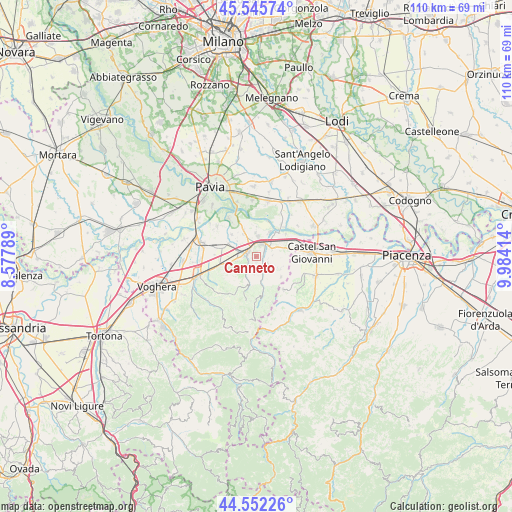
Canneto GPS coordinates[2]
45° 3' 4.176" North, 9° 16' 51.636" East
| Map corner | latitude | longitude |
|---|---|---|
| Upper-left | 45.54574°, | 8.57789° |
| Center: | 45.05116°, | 9.28101° |
| Lower-right: | 44.55226°, | 9.98414° |
| Map W x H: | 110.5×110.5 km | = 68.7×68.7mi |
| max Lat: | 47.04031° ⇑38.8% North |
| Canneto: | 45.05116° |
| min Lat: | ⇓61.2% South 35.50142° |
| min Long | Canneto | max Long |
| 6.69888° | 9.28101° | 18.48682° |
| W 23.3%⇐ | ⇒76.7% E |
Elevation
Elevation of Canneto is 229 m = 751 ft, and this is 77.7 m = 255 ft below average elevation for this country.
| Max E: |
2085 m = 6841 ft | 50.9% |
| Avg. | 306.7 m = 1006 ft | |
| Canneto | 229 m = 751 ft | |
Min E: |
-4 m = -13 ft | 49.1% |
See also: Italy elevation on elevation.city.
Geographical zone
Canneto is located in North temperate zone (between Tropic of Cancer and the Arctic Circle). Distance of this North polar circle is 2392 km =1486.3 mi to North.| Distance of | km | miles | from Canneto |
|---|---|---|---|
| North Pole | 4997.8 | 3105.5 | to North |
| Arctic Circle | 2392 | 1486.3 | to North |
| Tropic Cancer | 2403.3 | 1493.3 | to South |
| Equator | 5009.2 | 3112.6 | to South |


Nearby cities:
15 places around Canneto: (largest is in red/bold)
• Bosnasco
6.1 km =3.8 mi,  76°
76°
• Broni
2.2 km =1.4 mi,  310°
310°
• Campospinoso
5.5 km =3.4 mi,  329°
329°
• Canneto Pavese
0.2 km =0.1 mi,  246°
246°
• Castana
2.8 km =1.7 mi,  193°
193°
• Cigognola
3.5 km =2.2 mi,  234°
234°
• Montescano
2.1 km =1.3 mi,  174°
174°
• Montù Beccaria
3 km =1.9 mi,  123°
123°
• Pietra de' Giorgi
5.2 km =3.2 mi, 230°
• Portalbera
5.9 km =3.7 mi,  29°
29°
• Redavalle
6.4 km =4 mi,  256°
256°
• San Damiano al Colle
5.9 km =3.7 mi, 116°
• Stradella
3.1 km =1.9 mi, 32°
• Vallescuropasso-Località Stefano
2.9 km =1.8 mi,  271°
271°
• Zenevredo
3.6 km =2.2 mi,  85°
85°
Sources, notices
• [Note1] Compared only with cities in Italy existing in our database
• [Src1] Map data: © OpenStreetMap contributors (CC-BY-SA)
• [Src2] Other city data from geonames.org with taken over terms of usage.
• [Src3] Geographical zone / Annual Mean Temperature by Robert A. Rohde @ Wikipedia
