Valsanzibio geodata
Valsanzibio (Veneto) is a populated locality; located in Italy in Europe/Rome (GMT+2) time zone. With population of 759 people, there are 7889 cities with bigger population in this country. Compared to other cities in Italy, 67.3% of cities are located further ↓South; 52.2% of cities are located further ←West and 84.1% of cities have higher elevation than Valsanzibio. Note1


Valsanzibio GPS coordinates[2]
45° 17' 36.6" North, 11° 43' 24.492" East
| Map corner | latitude | longitude |
|---|---|---|
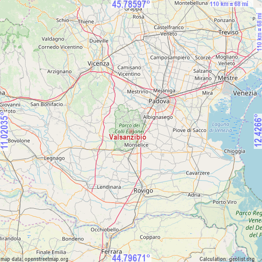
| Upper-left | 45.78597°, | 11.02035° |
| Center: | 45.2935°, | 11.72347° |
| Lower-right: | 44.79671°, | 12.4266° |
| Map W x H: | 110×110 km | = 68.4×68.4mi |
| max Lat: | 47.04031° ⇑32.7% North |
| Valsanzibio: | 45.2935° |
| min Lat: | ⇓67.3% South 35.50142° |
| min Long | Valsanzibio | max Long |
| 6.69888° | 11.72347° | 18.48682° |
| W 52.2%⇐ | ⇒47.8% E |
Elevation
Elevation of Valsanzibio is 34 m = 112 ft, and this is 272.7 m = 895 ft below average elevation for this country.
| Max E: |
2085 m = 6841 ft | 84.1% |
| Avg. | 306.7 m = 1006 ft | |
| Valsanzibio | 34 m = 112 ft | |
Min E: |
-4 m = -13 ft | 15.9% |
See also: Italy elevation on elevation.city.
Geographical zone
Valsanzibio is located in North temperate zone (between Tropic of Cancer and the Arctic Circle). Distance of this North polar circle is 2365 km =1469.5 mi to North.| Distance of | km | miles | from Valsanzibio |
|---|---|---|---|
| North Pole | 4970.9 | 3088.8 | to North |
| Arctic Circle | 2365 | 1469.5 | to North |
| Tropic Cancer | 2430.2 | 1510.1 | to South |
| Equator | 5036.2 | 3129.3 | to South |


Nearby cities:
15 places around Valsanzibio: (largest is in red/bold)
• Arquà Petrarca
2.7 km =1.7 mi,  184°
184°
• Baone
6.5 km =4 mi,  207°
207°
• Battaglia Terme
4.8 km =3 mi,  100°
100°
• Carrara San Giorgio
7.4 km =4.6 mi,  90°
90°
• Due Carrare
7.9 km =4.9 mi, 91°
• Fontanafredda
4.8 km =3 mi,  267°
267°
• Galzignano
1.7 km =1.1 mi,  20°
20°
• Mezzavia
7.6 km =4.7 mi,  65°
65°
• Monselice
6.4 km =4 mi,  161°
161°
• Montegrotto Terme
6.5 km =4 mi,  49°
49°
• Pernumia
6.3 km =3.9 mi,  127°
127°
• Rivadolmo
7.9 km =4.9 mi,  231°
231°
• Torreglia
4.8 km =3 mi,  11°
11°
• Treponti
8.3 km =5.2 mi,  352°
352°
• Vò
7.5 km =4.7 mi,  301°
301°
Sources, notices
• [Note1] Compared only with cities in Italy existing in our database
• [Src1] Map data: © OpenStreetMap contributors (CC-BY-SA)
• [Src2] Other city data from geonames.org with taken over terms of usage.
• [Src3] Geographical zone / Annual Mean Temperature by Robert A. Rohde @ Wikipedia
