Torreglia geodata
Torreglia (Veneto) is a seat of a third-order administrative division; located in Italy in Europe/Rome (GMT+2) time zone. With population of 5,241 people, there are 1862 cities with bigger population in this country. Compared to other cities in Italy, 68.5% of cities are located further ↓South; 52.3% of cities are located further ←West and 93.6% of cities have higher elevation than Torreglia. Note1


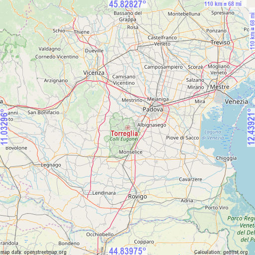
Torreglia GPS coordinates[2]
45° 20' 10.212" North, 11° 44' 9.888" East
| Map corner | latitude | longitude |
|---|---|---|
| Upper-left | 45.82827°, | 11.03296° |
| Center: | 45.33617°, | 11.73608° |
| Lower-right: | 44.83975°, | 12.43921° |
| Map W x H: | 109.9×109.9 km | = 68.3×68.3mi |
| max Lat: | 47.04031° ⇑31.5% North |
| Torreglia: | 45.33617° |
| min Lat: | ⇓68.5% South 35.50142° |
| min Long | Torreglia | max Long |
| 6.69888° | 11.73608° | 18.48682° |
| W 52.3%⇐ | ⇒47.7% E |
Elevation
Elevation of Torreglia is 11 m = 36 ft, and this is 295.7 m = 970 ft below average elevation for this country.
| Max E: |
2085 m = 6841 ft | 93.6% |
| Avg. | 306.7 m = 1006 ft | |
| Torreglia | 11 m = 36 ft | |
Min E: |
-4 m = -13 ft | 6.4% |
See also: Italy elevation on elevation.city.
Geographical zone
Torreglia is located in North temperate zone (between Tropic of Cancer and the Arctic Circle). Distance of this North polar circle is 2360.3 km =1466.6 mi to North.| Distance of | km | miles | from Torreglia |
|---|---|---|---|
| North Pole | 4966.2 | 3085.9 | to North |
| Arctic Circle | 2360.3 | 1466.6 | to North |
| Tropic Cancer | 2435 | 1513 | to South |
| Equator | 5040.9 | 3132.3 | to South |


Nearby cities:
15 places around Torreglia: (largest is in red/bold)
• Abano Terme
4.7 km =2.9 mi,  59°
59°
• Arquà Petrarca
7.6 km =4.7 mi,  189°
189°
• Battaglia Terme
6.8 km =4.2 mi,  146°
146°
• Feriole
4.6 km =2.9 mi,  17°
17°
• Galzignano
3.2 km =2 mi, 186°
• Mezzavia
6.1 km =3.8 mi,  104°
104°
• Montegrotto Terme
4 km =2.5 mi, 98°
• Montemerlo
5.4 km =3.4 mi,  336°
336°
• Saccolongo
7.3 km =4.5 mi,  7°
7°
• San Biagio
4.3 km =2.7 mi,  1°
1°
• Selvazzano Dentro
7.2 km =4.5 mi,  37°
37°
• Terradura
7 km =4.3 mi, 102°
• Treponti
4.1 km =2.5 mi,  328°
328°
• Valsanzibio
4.8 km =3 mi, 191°
• Vò
7.4 km =4.6 mi,  263°
263°
Sources, notices
• [Note1] Compared only with cities in Italy existing in our database
• [Src1] Map data: © OpenStreetMap contributors (CC-BY-SA)
• [Src2] Other city data from geonames.org with taken over terms of usage.
• [Src3] Geographical zone / Annual Mean Temperature by Robert A. Rohde @ Wikipedia
