Tonnarella geodata
Tonnarella (Sicily) is a populated place; located in Italy in Europe/Rome (GMT+2) time zone. With population of 1,193 people, there are 5982 cities with bigger population in this country. Compared to other cities in Italy, 95.5% of cities are located further ↑North; 88.1% of cities are located further ←West and 97.2% of cities have higher elevation than Tonnarella. Note1


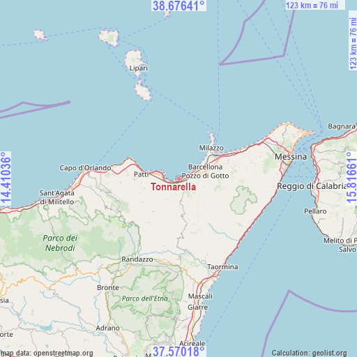
Tonnarella GPS coordinates[2]
38° 7' 31.404" North, 15° 6' 48.528" East
| Map corner | latitude | longitude |
|---|---|---|
| Upper-left | 38.67641°, | 14.41036° |
| Center: | 38.12539°, | 15.11348° |
| Lower-right: | 37.57018°, | 15.81661° |
| Map W x H: | 123×123 km | = 76.4×76.4mi |
| max Lat: | 47.04031° ⇑95.5% North |
| Tonnarella: | 38.12539° |
| min Lat: | ⇓4.5% South 35.50142° |
| min Long | Tonnarella | max Long |
| 6.69888° | 15.11348° | 18.48682° |
| W 88.1%⇐ | ⇒11.9% E |
Elevation
Elevation of Tonnarella is 5 m = 16 ft, and this is 301.7 m = 990 ft below average elevation for this country.
| Max E: |
2085 m = 6841 ft | 97.2% |
| Avg. | 306.7 m = 1006 ft | |
| Tonnarella | 5 m = 16 ft | |
Min E: |
-4 m = -13 ft | 2.8% |
See also: Italy elevation on elevation.city.
Geographical zone
Tonnarella is located in North temperate zone (between Tropic of Cancer and the Arctic Circle). Distance of this Northern Tropic circle is 1633.2 km =1014.8 mi to South.| Distance of | km | miles | from Tonnarella |
|---|---|---|---|
| North Pole | 5767.9 | 3584 | to North |
| Arctic Circle | 3162 | 1964.8 | to North |
| Tropic Cancer | 1633.2 | 1014.8 | to South |
| Equator | 4239.1 | 2634.1 | to South |


Nearby cities:
15 places around Tonnarella: (largest is in red/bold)
• Acquaficara
8.2 km =5.1 mi,  87°
87°
• Bafia
9.8 km =6.1 mi,  125°
125°
• Barcellona Pozzo di Gotto
9.2 km =5.7 mi,  74°
74°
• Basicò
8.5 km =5.3 mi,  211°
211°
• Castroreale
9 km =5.6 mi,  109°
109°
• Falcone
3.1 km =1.9 mi,  252°
252°
• Furnari
2.5 km =1.6 mi,  159°
159°
• Mazzarrà Sant'Andrea
4.4 km =2.7 mi,  154°
154°
• Mongiove
9 km =5.6 mi,  286°
286°
• Oliveri
4.6 km =2.9 mi,  269°
269°
• Protonotaro
6.9 km =4.3 mi, 94°
• Rodì
5.2 km =3.2 mi, 111°
• Terme
3.9 km =2.4 mi, 72°
• Tripi
8.9 km =5.5 mi,  189°
189°
• Vigliatore 2
1.5 km =0.9 mi,  103°
103°
Sources, notices
• [Note1] Compared only with cities in Italy existing in our database
• [Src1] Map data: © OpenStreetMap contributors (CC-BY-SA)
• [Src2] Other city data from geonames.org with taken over terms of usage.
• [Src3] Geographical zone / Annual Mean Temperature by Robert A. Rohde @ Wikipedia
