Sant'Andrea Bonagia geodata
Sant'Andrea Bonagia (Sicily) is a populated locality; located in Italy in Europe/Rome (GMT+2) time zone. With population of 807 people, there are 7612 cities with bigger population in this country. Compared to other cities in Italy, 96% of cities are located further ↑North; 63.9% of cities are located further ←West and 92.6% of cities have higher elevation than Sant'Andrea Bonagia. Note1


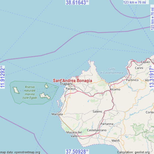
Sant'Andrea Bonagia GPS coordinates[2]
38° 3' 53.82" North, 12° 36' 57.744" East
| Map corner | latitude | longitude |
|---|---|---|
| Upper-left | 38.61643°, | 11.91292° |
| Center: | 38.06495°, | 12.61604° |
| Lower-right: | 37.50928°, | 13.31917° |
| Map W x H: | 123.1×123.1 km | = 76.5×76.5mi |
| max Lat: | 47.04031° ⇑96% North |
| Sant'Andrea Bonagia: | 38.06495° |
| min Lat: | ⇓4% South 35.50142° |
| min Long | Sant'Andrea Bon | max Long |
| 6.69888° | 12.61604° | 18.48682° |
| W 63.9%⇐ | ⇒36.1% E |
Elevation
Elevation of Sant'Andrea Bonagia is 13 m = 43 ft, and this is 293.7 m = 964 ft below average elevation for this country.
| Max E: |
2085 m = 6841 ft | 92.6% |
| Avg. | 306.7 m = 1006 ft | |
| Sant'Andrea Bonagia | 13 m = 43 ft | |
Min E: |
-4 m = -13 ft | 7.4% |
See also: Italy elevation on elevation.city.
Geographical zone
Sant'Andrea Bonagia is located in North temperate zone (between Tropic of Cancer and the Arctic Circle). Distance of this Northern Tropic circle is 1626.5 km =1010.7 mi to South.| Distance of | km | miles | from Sant'Andrea Bonagia |
|---|---|---|---|
| North Pole | 5774.6 | 3588.2 | to North |
| Arctic Circle | 3168.7 | 1968.9 | to North |
| Tropic Cancer | 1626.5 | 1010.7 | to South |
| Equator | 4232.4 | 2629.9 | to South |


Nearby cities:
15 places around Sant'Andrea Bonagia: (largest is in red/bold)
• Buseto Palizzolo
10.6 km =6.6 mi,  130°
130°
• Casa Santa
7.4 km =4.6 mi,  233°
233°
• Castelluzzo
11.2 km =7 mi,  69°
69°
• Chiesanuova
6.1 km =3.8 mi,  151°
151°
• Crocevie
4.6 km =2.9 mi, 134°
• Custonaci
6.3 km =3.9 mi,  75°
75°
• Erice
3.9 km =2.4 mi,  219°
219°
• Napola
8.4 km =5.2 mi,  170°
170°
• Nubia
13.2 km =8.2 mi, 222°
• Paceco
10.7 km =6.6 mi,  208°
208°
• Pizzolungo
4.5 km =2.8 mi,  264°
264°
• Rigaletta
6.5 km =4 mi, 207°
• Tonnara di Bonagia
1.9 km =1.2 mi, 263°
• Trapani
8.8 km =5.5 mi, 233°
• Valderice
2.8 km =1.7 mi,  181°
181°
Sources, notices
• [Note1] Compared only with cities in Italy existing in our database
• [Src1] Map data: © OpenStreetMap contributors (CC-BY-SA)
• [Src2] Other city data from geonames.org with taken over terms of usage.
• [Src3] Geographical zone / Annual Mean Temperature by Robert A. Rohde @ Wikipedia
