Feriolo geodata
Feriolo (Piedmont) is a populated place; located in Italy in Europe/Rome (GMT+2) time zone. With population of 890 people, there are 7207 cities with bigger population in this country. Compared to other cities in Italy, 90.1% of cities are located further ↓South; 88.2% of cities are located further →East and 54.3% of cities have higher elevation than Feriolo. Note1
Administrative division(s):
- Level 1: Piedmont
- Level 2: Provincia Verbano-Cusio-Ossola
- Level 3: Baveno


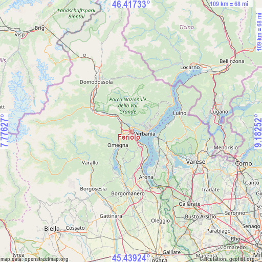
Feriolo GPS coordinates[2]
45° 55' 49.584" North, 8° 28' 45.804" East
| Map corner | latitude | longitude |
|---|---|---|
| Upper-left | 46.41733°, | 7.77627° |
| Center: | 45.93044°, | 8.47939° |
| Lower-right: | 45.43924°, | 9.18252° |
| Map W x H: | 108.8×108.8 km | = 67.6×67.6mi |
| max Lat: | 47.04031° ⇑9.9% North |
| Feriolo: | 45.93044° |
| min Lat: | ⇓90.1% South 35.50142° |
| min Long | Feriolo | max Long |
| 6.69888° | 8.47939° | 18.48682° |
| W 11.8%⇐ | ⇒88.2% E |
Elevation
Elevation of Feriolo is 207 m = 679 ft, and this is 99.7 m = 327 ft below average elevation for this country.
| Max E: |
2085 m = 6841 ft | 54.3% |
| Avg. | 306.7 m = 1006 ft | |
| Feriolo | 207 m = 679 ft | |
Min E: |
-4 m = -13 ft | 45.7% |
See also: Italy elevation on elevation.city.
Geographical zone
Feriolo is located in North temperate zone (between Tropic of Cancer and the Arctic Circle). Distance of this North polar circle is 2294.2 km =1425.5 mi to North.| Distance of | km | miles | from Feriolo |
|---|---|---|---|
| North Pole | 4900.1 | 3044.8 | to North |
| Arctic Circle | 2294.2 | 1425.5 | to North |
| Tropic Cancer | 2501.1 | 1554.1 | to South |
| Equator | 5107 | 3173.3 | to South |


Nearby cities:
15 places around Feriolo: (largest is in red/bold)
• Baveno
3 km =1.9 mi,  146°
146°
• Bieno
3.5 km =2.2 mi,  47°
47°
• Cambiasca
6.2 km =3.9 mi, 54°
• Casale Corte Cerro
5.3 km =3.3 mi,  251°
251°
• Cossogno
4.4 km =2.7 mi,  31°
31°
• Fondotoce
2 km =1.2 mi, 29°
• Gabbio-Cereda-Ramate
5.1 km =3.2 mi,  242°
242°
• Gravellona Toce
3.7 km =2.3 mi,  266°
266°
• Mergozzo
4 km =2.5 mi,  331°
331°
• Miazzina
6.1 km =3.8 mi, 33°
• Ornavasso
6.4 km =4 mi,  310°
310°
• Pallanza-Intra-Suna
7.1 km =4.4 mi,  83°
83°
• San Bernardino Verbano
4.2 km =2.6 mi, 46°
• Santino
4.2 km =2.6 mi, 47°
• Verbania
5.7 km =3.5 mi,  100°
100°
Sources, notices
• [Note1] Compared only with cities in Italy existing in our database
• [Src1] Map data: © OpenStreetMap contributors (CC-BY-SA)
• [Src2] Other city data from geonames.org with taken over terms of usage.
• [Src3] Geographical zone / Annual Mean Temperature by Robert A. Rohde @ Wikipedia
