Agliate geodata
Agliate (Lombardy) is a populated place; located in Italy in Europe/Rome (GMT+2) time zone. With population of 867 people, there are 7328 cities with bigger population in this country. Compared to other cities in Italy, 80.5% of cities are located further ↓South; 77.5% of cities are located further →East and 52.5% of cities have higher elevation than Agliate. Note1
Administrative division(s):
- Level 1: Lombardy
- Level 2: Provincia di Monza e della Brianza
- Level 3: Carate Brianza


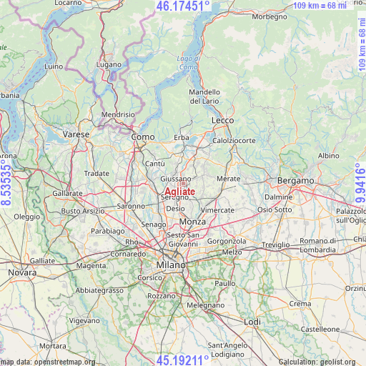
Agliate GPS coordinates[2]
45° 41' 7.692" North, 9° 14' 18.492" East
| Map corner | latitude | longitude |
|---|---|---|
| Upper-left | 46.17451°, | 8.53535° |
| Center: | 45.68547°, | 9.23847° |
| Lower-right: | 45.19211°, | 9.9416° |
| Map W x H: | 109.2×109.2 km | = 67.9×67.9mi |
| max Lat: | 47.04031° ⇑19.5% North |
| Agliate: | 45.68547° |
| min Lat: | ⇓80.5% South 35.50142° |
| min Long | Agliate | max Long |
| 6.69888° | 9.23847° | 18.48682° |
| W 22.5%⇐ | ⇒77.5% E |
Elevation
Elevation of Agliate is 219 m = 719 ft, and this is 87.7 m = 288 ft below average elevation for this country.
| Max E: |
2085 m = 6841 ft | 52.5% |
| Avg. | 306.7 m = 1006 ft | |
| Agliate | 219 m = 719 ft | |
Min E: |
-4 m = -13 ft | 47.5% |
See also: Italy elevation on elevation.city.
Geographical zone
Agliate is located in North temperate zone (between Tropic of Cancer and the Arctic Circle). Distance of this North polar circle is 2321.4 km =1442.5 mi to North.| Distance of | km | miles | from Agliate |
|---|---|---|---|
| North Pole | 4927.3 | 3061.7 | to North |
| Arctic Circle | 2321.4 | 1442.5 | to North |
| Tropic Cancer | 2473.8 | 1537.1 | to South |
| Equator | 5079.7 | 3156.4 | to South |


Nearby cities:
15 places around Agliate: (largest is in red/bold)
• Albiate
3.5 km =2.2 mi,  164°
164°
• Arosio
4.4 km =2.7 mi,  327°
327°
• Briosco
2.7 km =1.7 mi,  3°
3°
• Calò
2 km =1.2 mi,  110°
110°
• Capriano
4.4 km =2.7 mi,  17°
17°
• Carate Brianza
1.1 km =0.7 mi,  185°
185°
• Carugo
4.1 km =2.5 mi,  308°
308°
• Costa Lambro
0.7 km =0.4 mi,  91°
91°
• Fornaci
4.6 km =2.9 mi, 2°
• Giussano
2.8 km =1.7 mi, 305°
• Tregasio
3.9 km =2.4 mi,  102°
102°
• Triuggio
3.5 km =2.2 mi,  140°
140°
• Verano Brianza
1.1 km =0.7 mi,  288°
288°
• Villa Raverio
2 km =1.2 mi,  68°
68°
• Zoccorino-Vergo
1.8 km =1.1 mi,  41°
41°
Sources, notices
• [Note1] Compared only with cities in Italy existing in our database
• [Src1] Map data: © OpenStreetMap contributors (CC-BY-SA)
• [Src2] Other city data from geonames.org with taken over terms of usage.
• [Src3] Geographical zone / Annual Mean Temperature by Robert A. Rohde @ Wikipedia
