Tivolille Pasquali-Merenzata geodata
Tivolille Pasquali-Merenzata (Calabria) is a populated place; located in Italy in Europe/Rome (GMT+1) time zone. With population of 4,381 people, there are 2199 cities with bigger population in this country. Compared to other cities in Italy, 91.4% of cities are located further ↑North; 94.5% of cities are located further ←West and 72.7% of cities have lower elevation than Tivolille Pasquali-Merenzata. Note1
Current local time in Tivolille Pasquali-Merenzata:
04:42 AM, SundayDifference from your time zone: hours


Tivolille Pasquali-Merenzata GPS coordinates[2]
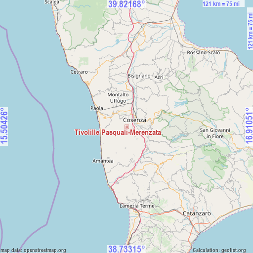
39° 16' 46.308" North, 16° 12' 26.568" East
| Map corner | latitude | longitude |
|---|---|---|
| Upper-left | 39.82168°, | 15.50426° |
| Center: | 39.27953°, | 16.20738° |
| Lower-right: | 38.73315°, | 16.91051° |
| Map W x H: | 121×121 km | = 75.2×75.2mi |
| max Lat: | 47.04031° ⇑91.4% North |
| Tivolille Pasquali-Merenzata: | 39.27953° |
| min Lat: | ⇓8.6% South 35.50142° |
| min Long | Tivolille Pasqu | max Long |
| 6.69888° | 16.20738° | 18.48682° |
| W 94.5%⇐ | ⇒5.5% E |
Elevation
Elevation of Tivolille Pasquali-Merenzata is 422 m = 1385 ft, and this is 115.3 m = 378 ft above average elevation for this country.
| Max E: |
2085 m = 6841 ft | 27.3% |
| Tivolille Pasquali-Merenzata | 422 m 1385 ft | |
| Avg. | 306.7 m = 1006 ft | |
Min E: |
-4 m = -13 ft | 72.7% |
See also: Italy elevation on elevation.city.
Geographical zone
Tivolille Pasquali-Merenzata is located in North temperate zone (between Tropic of Cancer and the Arctic Circle). Distance of this Northern Tropic circle is 1761.6 km =1094.6 mi to South.| Distance of | km | miles | from Tivolille Pasquali-Merenzata |
|---|---|---|---|
| North Pole | 5639.6 | 3504.3 | to North |
| Arctic Circle | 3033.7 | 1885.1 | to North |
| Tropic Cancer | 1761.6 | 1094.6 | to South |
| Equator | 4367.5 | 2713.8 | to South |


Nearby cities:
15 places around Tivolille Pasquali-Merenzata: (largest is in red/bold)
• Andreotta
3.2 km =2 mi,  15°
15°
• Carolei
3 km =1.9 mi,  158°
158°
• Castrolibero
3.6 km =2.2 mi,  341°
341°
• Cerisano
2.7 km =1.7 mi,  264°
264°
• Cosenza
4.5 km =2.8 mi,  61°
61°
• Fontanesi-Santa Lucia
2.8 km =1.7 mi,  329°
329°
• Laurignano
3 km =1.9 mi,  90°
90°
• Marano Marchesato
4.7 km =2.9 mi,  321°
321°
• Marano Principato
3.5 km =2.2 mi,  305°
305°
• Mendicino
2.2 km =1.4 mi,  210°
210°
• Ortomatera
5 km =3.1 mi,  6°
6°
• Rosario
2.4 km =1.5 mi, 58°
• Serra Miceli
2.9 km =1.8 mi,  349°
349°
• Surdo
5.4 km =3.4 mi, 354°
• Vadue
1.8 km =1.1 mi, 86°
Sources, notices
• [Note1] Compared only with cities in Italy existing in our database
• [Src1] Map data: © OpenStreetMap contributors (CC-BY-SA)
• [Src2] Other city data from geonames.org with taken over terms of usage.
• [Src3] Geographical zone / Annual Mean Temperature by Robert A. Rohde @ Wikipedia
