Chianchitta-Trappitello geodata
Chianchitta-Trappitello (Sicily) is a populated place; located in Italy in Europe/Rome (GMT+2) time zone. With population of 4,029 people, there are 2376 cities with bigger population in this country. Compared to other cities in Italy, 97.6% of cities are located further ↑North; 89.2% of cities are located further ←West and 80.5% of cities have higher elevation than Chianchitta-Trappitello. Note1
Current local time in Chianchitta-Trappitello:
10:57 PM, WednesdayDifference from your time zone: hours


Chianchitta-Trappitello GPS coordinates[2]
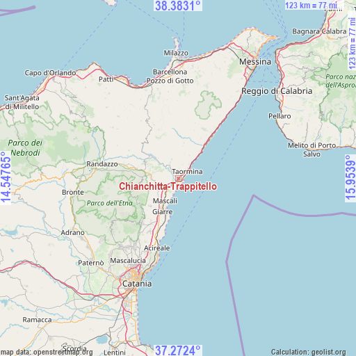
37° 49' 47.424" North, 15° 15' 2.772" East
| Map corner | latitude | longitude |
|---|---|---|
| Upper-left | 38.3831°, | 14.54765° |
| Center: | 37.82984°, | 15.25077° |
| Lower-right: | 37.2724°, | 15.9539° |
| Map W x H: | 123.5×123.5 km | = 76.7×76.7mi |
| max Lat: | 47.04031° ⇑97.6% North |
| Chianchitta-Trappitello: | 37.82984° |
| min Lat: | ⇓2.4% South 35.50142° |
| min Long | Chianchitta-Tra | max Long |
| 6.69888° | 15.25077° | 18.48682° |
| W 89.2%⇐ | ⇒10.8% E |
Elevation
Elevation of Chianchitta-Trappitello is 47 m = 154 ft, and this is 259.7 m = 852 ft below average elevation for this country.
| Max E: |
2085 m = 6841 ft | 80.5% |
| Avg. | 306.7 m = 1006 ft | |
| Chianchitta-Trappitello | 47 m = 154 ft | |
Min E: |
-4 m = -13 ft | 19.5% |
See also: Italy elevation on elevation.city.
Geographical zone
Chianchitta-Trappitello is located in North temperate zone (between Tropic of Cancer and the Arctic Circle). Distance of this Northern Tropic circle is 1600.4 km =994.4 mi to South.| Distance of | km | miles | from Chianchitta-Trappitello |
|---|---|---|---|
| North Pole | 5800.8 | 3604.4 | to North |
| Arctic Circle | 3194.9 | 1985.2 | to North |
| Tropic Cancer | 1600.4 | 994.4 | to South |
| Equator | 4206.3 | 2613.7 | to South |


Nearby cities:
15 places around Chianchitta-Trappitello: (largest is in red/bold)
• Calatabiano
2 km =1.2 mi,  239°
239°
• Castelmola
3.9 km =2.4 mi,  36°
36°
• Chianchitta-Pallio
1 km =0.6 mi,  167°
167°
• Fiumefreddo Sicilia
5.6 km =3.5 mi,  220°
220°
• Gaggi
4.2 km =2.6 mi,  322°
322°
• Gallodoro
8.9 km =5.5 mi,  25°
25°
• Giardini-Naxos
1.5 km =0.9 mi,  100°
100°
• Graniti
7.1 km =4.4 mi,  340°
340°
• Letojanni
7.5 km =4.7 mi, 41°
• Mazzeo
6.4 km =4 mi, 43°
• Melia
8.5 km =5.3 mi,  14°
14°
• Mongiuffi Melia
8.5 km =5.3 mi, 14°
• Pasteria-Lapide
3 km =1.9 mi, 222°
• Piedimonte Etneo
7.1 km =4.4 mi,  248°
248°
• Taormina
4.2 km =2.6 mi,  51°
51°
Sources, notices
• [Note1] Compared only with cities in Italy existing in our database
• [Src1] Map data: © OpenStreetMap contributors (CC-BY-SA)
• [Src2] Other city data from geonames.org with taken over terms of usage.
• [Src3] Geographical zone / Annual Mean Temperature by Robert A. Rohde @ Wikipedia
