Valleggia geodata
Valleggia (Liguria) is a populated place; located in Italy in Europe/Rome (GMT+2) time zone. With population of 3,086 people, there are 2977 cities with bigger population in this country. Compared to other cities in Italy, 52.1% of cities are located further ↑North; 88.7% of cities are located further →East and 94.8% of cities have higher elevation than Valleggia. Note1


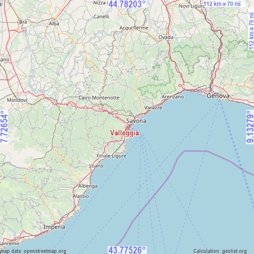
Valleggia GPS coordinates[2]
44° 16' 50.88" North, 8° 25' 46.812" East
| Map corner | latitude | longitude |
|---|---|---|
| Upper-left | 44.78203°, | 7.72654° |
| Center: | 44.2808°, | 8.42967° |
| Lower-right: | 43.77526°, | 9.13279° |
| Map W x H: | 111.9×111.9 km | = 69.5×69.5mi |
| max Lat: | 47.04031° ⇑52.1% North |
| Valleggia: | 44.2808° |
| min Lat: | ⇓47.9% South 35.50142° |
| min Long | Valleggia | max Long |
| 6.69888° | 8.42967° | 18.48682° |
| W 11.3%⇐ | ⇒88.7% E |
Elevation
Elevation of Valleggia is 9 m = 30 ft, and this is 297.7 m = 977 ft below average elevation for this country.
| Max E: |
2085 m = 6841 ft | 94.8% |
| Avg. | 306.7 m = 1006 ft | |
| Valleggia | 9 m = 30 ft | |
Min E: |
-4 m = -13 ft | 5.2% |
See also: Italy elevation on elevation.city.
Geographical zone
Valleggia is located in North temperate zone (between Tropic of Cancer and the Arctic Circle). Distance of this Northern Tropic circle is 2317.6 km =1440.1 mi to South.| Distance of | km | miles | from Valleggia |
|---|---|---|---|
| North Pole | 5083.5 | 3158.7 | to North |
| Arctic Circle | 2477.6 | 1539.5 | to North |
| Tropic Cancer | 2317.6 | 1440.1 | to South |
| Equator | 4923.6 | 3059.4 | to South |


Nearby cities:
15 places around Valleggia: (largest is in red/bold)
• Albisola Marina
8.4 km =5.2 mi,  48°
48°
• Albisola Superiore
9.1 km =5.7 mi,  44°
44°
• Bergeggi
3.8 km =2.4 mi,  162°
162°
• Ellera
9.7 km =6 mi,  16°
16°
• Noli
8.4 km =5.2 mi,  188°
188°
• Quiliano
1.8 km =1.1 mi,  315°
315°
• Sant'Ermete
3.6 km =2.2 mi,  220°
220°
• Santuario
7.2 km =4.5 mi,  9°
9°
• Savona
4.9 km =3 mi, 50°
• Spotorno
6.1 km =3.8 mi, 189°
• Vado Centro
1.4 km =0.9 mi,  171°
171°
• Vado Ligure
1.3 km =0.8 mi, 165°
• Valle di Vado
2.5 km =1.6 mi,  210°
210°
• Vezzi Portio
7.7 km =4.8 mi, 221°
• Voze
7.9 km =4.9 mi,  200°
200°
Sources, notices
• [Note1] Compared only with cities in Italy existing in our database
• [Src1] Map data: © OpenStreetMap contributors (CC-BY-SA)
• [Src2] Other city data from geonames.org with taken over terms of usage.
• [Src3] Geographical zone / Annual Mean Temperature by Robert A. Rohde @ Wikipedia
