Le Rughe geodata
Le Rughe (Latium) is a populated place; located in Italy in Europe/Rome (GMT+2) time zone. With population of 2,879 people, there are 3136 cities with bigger population in this country. Compared to other cities in Italy, 69.7% of cities are located further ↑North; 61% of cities are located further ←West and 56.5% of cities have higher elevation than Le Rughe. Note1
Administrative division(s):
- Level 1: Latium
- Level 2: Città metropolitana di Roma Capitale
- Level 3: Formello


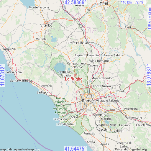
Le Rughe GPS coordinates[2]
42° 4' 7.86" North, 12° 22' 34.464" East
| Map corner | latitude | longitude |
|---|---|---|
| Upper-left | 42.58866°, | 11.67312° |
| Center: | 42.06885°, | 12.37624° |
| Lower-right: | 41.54475°, | 13.07937° |
| Map W x H: | 116.1×116.1 km | = 72.1×72.1mi |
| max Lat: | 47.04031° ⇑69.7% North |
| Le Rughe: | 42.06885° |
| min Lat: | ⇓30.3% South 35.50142° |
| min Long | Le Rughe | max Long |
| 6.69888° | 12.37624° | 18.48682° |
| W 61%⇐ | ⇒39% E |
Elevation
Elevation of Le Rughe is 191 m = 627 ft, and this is 115.7 m = 380 ft below average elevation for this country.
| Max E: |
2085 m = 6841 ft | 56.5% |
| Avg. | 306.7 m = 1006 ft | |
| Le Rughe | 191 m = 627 ft | |
Min E: |
-4 m = -13 ft | 43.5% |
See also: Italy elevation on elevation.city.
Geographical zone
Le Rughe is located in North temperate zone (between Tropic of Cancer and the Arctic Circle). Distance of this Northern Tropic circle is 2071.7 km =1287.3 mi to South.| Distance of | km | miles | from Le Rughe |
|---|---|---|---|
| North Pole | 5329.4 | 3311.5 | to North |
| Arctic Circle | 2723.6 | 1692.4 | to North |
| Tropic Cancer | 2071.7 | 1287.3 | to South |
| Equator | 4677.6 | 2906.5 | to South |


Nearby cities:
15 places around Le Rughe: (largest is in red/bold)
• Anguillara Sabazia
7.7 km =4.8 mi,  278°
278°
• Campagnano di Roma
7.4 km =4.6 mi,  358°
358°
• Castelnuovo di Porto
12.6 km =7.8 mi,  61°
61°
• Cesano
3.3 km =2.1 mi, 279°
• Costaroni
13.3 km =8.3 mi,  85°
85°
• Formello
1.7 km =1.1 mi,  115°
115°
• Magliano Romano
11 km =6.8 mi,  26°
26°
• Monte Caminetto
8 km =5 mi, 91°
• Montelarco
13.8 km =8.6 mi,  40°
40°
• Osteria Nuova
6.6 km =4.1 mi,  237°
237°
• Poggio Ellera
5 km =3.1 mi, 355°
• Ponton dell'Elce
12.7 km =7.9 mi,  246°
246°
• Riano
11.7 km =7.3 mi,  76°
76°
• Sacrofano
7.1 km =4.4 mi, 56°
• Tragliatella Campitello
12 km =7.5 mi, 238°
Sources, notices
• [Note1] Compared only with cities in Italy existing in our database
• [Src1] Map data: © OpenStreetMap contributors (CC-BY-SA)
• [Src2] Other city data from geonames.org with taken over terms of usage.
• [Src3] Geographical zone / Annual Mean Temperature by Robert A. Rohde @ Wikipedia
