Colle Campano-Scrima geodata
Colle Campano-Scrima (Latium) is a populated place; located in Italy in Europe/Rome (GMT+2) time zone. With population of 1,958 people, there are 4234 cities with bigger population in this country. Compared to other cities in Italy, 73.7% of cities are located further ↑North; 73.1% of cities are located further ←West and 51.2% of cities have lower elevation than Colle Campano-Scrima. Note1
Current local time in Colle Campano-Scrima:
11:46 PM, WednesdayDifference from your time zone: hours


Colle Campano-Scrima GPS coordinates[2]
41° 37' 25.104" North, 13° 27' 48.096" East
| Map corner | latitude | longitude |
|---|---|---|
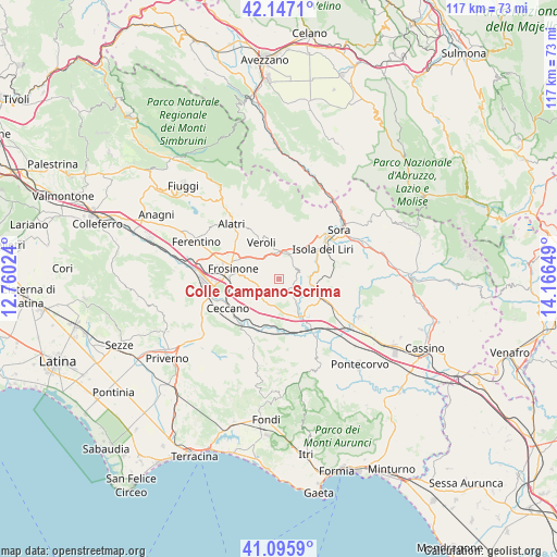
| Upper-left | 42.1471°, | 12.76024° |
| Center: | 41.62364°, | 13.46336° |
| Lower-right: | 41.0959°, | 14.16649° |
| Map W x H: | 116.9×116.9 km | = 72.6×72.6mi |
| max Lat: | 47.04031° ⇑73.7% North |
| Colle Campano-Scrima: | 41.62364° |
| min Lat: | ⇓26.3% South 35.50142° |
| min Long | Colle Campano-S | max Long |
| 6.69888° | 13.46336° | 18.48682° |
| W 73.1%⇐ | ⇒26.9% E |
Elevation
Elevation of Colle Campano-Scrima is 242 m = 794 ft, and this is 64.7 m = 212 ft below average elevation for this country.
| Max E: |
2085 m = 6841 ft | 48.8% |
| Avg. | 306.7 m = 1006 ft | |
| Colle Campano-Scrima | 242 m = 794 ft | |
Min E: |
-4 m = -13 ft | 51.2% |
See also: Italy elevation on elevation.city.
Geographical zone
Colle Campano-Scrima is located in North temperate zone (between Tropic of Cancer and the Arctic Circle). Distance of this Northern Tropic circle is 2022.2 km =1256.5 mi to South.| Distance of | km | miles | from Colle Campano-Scrima |
|---|---|---|---|
| North Pole | 5378.9 | 3342.3 | to North |
| Arctic Circle | 2773.1 | 1723.1 | to North |
| Tropic Cancer | 2022.2 | 1256.5 | to South |
| Equator | 4628.1 | 2875.8 | to South |


Nearby cities:
15 places around Colle Campano-Scrima: (largest is in red/bold)
• Antica Colle Piscioso
4.5 km =2.8 mi,  19°
19°
• Boville Ernica
2.2 km =1.4 mi, 20°
• Brecciaro
1.2 km =0.7 mi,  45°
45°
• Casavitola
3.6 km =2.2 mi,  330°
330°
• Case Campoli-Panetta
5.5 km =3.4 mi,  7°
7°
• Colli
6.2 km =3.9 mi,  110°
110°
• Girate
6.3 km =3.9 mi,  78°
78°
• La Lucca
3.7 km =2.3 mi,  91°
91°
• La Vittoria
6.3 km =3.9 mi, 329°
• Monte San Giovanni Campano
4.5 km =2.8 mi,  61°
61°
• Ripi
3.5 km =2.2 mi,  251°
251°
• Rotabile
4.1 km =2.5 mi,  0°
0°
• Sant'Angelo in Villa-Giglio
5.2 km =3.2 mi, 326°
• Strangolagalli
3.6 km =2.2 mi,  137°
137°
• Torrice
5.1 km =3.2 mi,  282°
282°
Sources, notices
• [Note1] Compared only with cities in Italy existing in our database
• [Src1] Map data: © OpenStreetMap contributors (CC-BY-SA)
• [Src2] Other city data from geonames.org with taken over terms of usage.
• [Src3] Geographical zone / Annual Mean Temperature by Robert A. Rohde @ Wikipedia
