Barbisano geodata
Barbisano (Veneto) is a populated place; located in Italy in Europe/Rome (GMT+2) time zone. With population of 1,954 people, there are 4239 cities with bigger population in this country. Compared to other cities in Italy, 88.7% of cities are located further ↓South; 58.5% of cities are located further ←West and 64.7% of cities have higher elevation than Barbisano. Note1


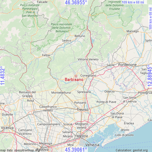
Barbisano GPS coordinates[2]
45° 52' 56.064" North, 12° 11' 10.752" East
| Map corner | latitude | longitude |
|---|---|---|
| Upper-left | 46.36955°, | 11.4832° |
| Center: | 45.88224°, | 12.18632° |
| Lower-right: | 45.39061°, | 12.88945° |
| Map W x H: | 108.8×108.8 km | = 67.6×67.6mi |
| max Lat: | 47.04031° ⇑11.3% North |
| Barbisano: | 45.88224° |
| min Lat: | ⇓88.7% South 35.50142° |
| min Long | Barbisano | max Long |
| 6.69888° | 12.18632° | 18.48682° |
| W 58.5%⇐ | ⇒41.5% E |
Elevation
Elevation of Barbisano is 129 m = 423 ft, and this is 177.7 m = 583 ft below average elevation for this country.
| Max E: |
2085 m = 6841 ft | 64.7% |
| Avg. | 306.7 m = 1006 ft | |
| Barbisano | 129 m = 423 ft | |
Min E: |
-4 m = -13 ft | 35.3% |
See also: Italy elevation on elevation.city.
Geographical zone
Barbisano is located in North temperate zone (between Tropic of Cancer and the Arctic Circle). Distance of this North polar circle is 2299.5 km =1428.8 mi to North.| Distance of | km | miles | from Barbisano |
|---|---|---|---|
| North Pole | 4905.4 | 3048.1 | to North |
| Arctic Circle | 2299.5 | 1428.8 | to North |
| Tropic Cancer | 2495.7 | 1550.8 | to South |
| Equator | 5101.6 | 3170 | to South |


Nearby cities:
15 places around Barbisano: (largest is in red/bold)
• Bagnolo
7.4 km =4.6 mi,  64°
64°
• Col San Martino
5.8 km =3.6 mi,  290°
290°
• Corbanese
8.2 km =5.1 mi,  30°
30°
• Falzè di Piave
1.7 km =1.1 mi,  199°
199°
• Farra di Soligo
5.4 km =3.4 mi,  298°
298°
• Moriago della Battaglia
6.9 km =4.3 mi,  254°
254°
• Moro
7.9 km =4.9 mi,  70°
70°
• Nervesa della Battaglia
7.8 km =4.8 mi,  173°
173°
• Pieve di Soligo
2.1 km =1.3 mi,  327°
327°
• Refrontolo
4.9 km =3 mi,  20°
20°
• San Pietro di Feletto
6.1 km =3.8 mi,  54°
54°
• Santa Lucia di Piave
8.6 km =5.3 mi,  105°
105°
• Santa Maria
4.1 km =2.5 mi, 66°
• Sernaglia della Battaglia
4.3 km =2.7 mi, 253°
• Susegana
6.2 km =3.9 mi,  117°
117°
Sources, notices
• [Note1] Compared only with cities in Italy existing in our database
• [Src1] Map data: © OpenStreetMap contributors (CC-BY-SA)
• [Src2] Other city data from geonames.org with taken over terms of usage.
• [Src3] Geographical zone / Annual Mean Temperature by Robert A. Rohde @ Wikipedia
