Fénis geodata
Fénis (Aosta Valley) is a seat of a third-order administrative division; located in Italy in Europe/Rome (GMT+2) time zone. With population of 1,667 people, there are 4743 cities with bigger population in this country. Compared to other cities in Italy, 82.8% of cities are located further ↓South; 97.8% of cities are located further →East and 81.4% of cities have lower elevation than Fénis. Note1


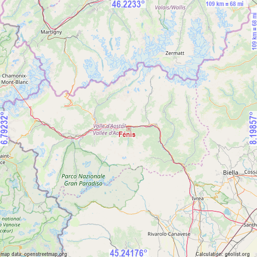
Fénis GPS coordinates[2]
45° 44' 4.884" North, 7° 29' 43.584" East
| Map corner | latitude | longitude |
|---|---|---|
| Upper-left | 46.2233°, | 6.79232° |
| Center: | 45.73469°, | 7.49544° |
| Lower-right: | 45.24176°, | 8.19857° |
| Map W x H: | 109.1×109.1 km | = 67.8×67.8mi |
| max Lat: | 47.04031° ⇑17.2% North |
| Fénis: | 45.73469° |
| min Lat: | ⇓82.8% South 35.50142° |
| min Long | Fénis | max Long |
| 6.69888° | 7.49544° | 18.48682° |
| W 2.2%⇐ | ⇒97.8% E |
Elevation
Elevation of Fénis is 544 m = 1785 ft, and this is 237.3 m = 779 ft above average elevation for this country.
| Max E: |
2085 m = 6841 ft | 18.6% |
| Fénis | 544 m 1785 ft | |
| Avg. | 306.7 m = 1006 ft | |
Min E: |
-4 m = -13 ft | 81.4% |
See also: Italy elevation on elevation.city.
Geographical zone
Fénis is located in North temperate zone (between Tropic of Cancer and the Arctic Circle). Distance of this North polar circle is 2316 km =1439.1 mi to North.| Distance of | km | miles | from Fénis |
|---|---|---|---|
| North Pole | 4921.8 | 3058.3 | to North |
| Arctic Circle | 2316 | 1439.1 | to North |
| Tropic Cancer | 2479.3 | 1540.6 | to South |
| Equator | 5085.2 | 3159.8 | to South |


Nearby cities:
15 places around Fénis: (largest is in red/bold)
• Chambave
4.3 km =2.7 mi,  75°
75°
• Chantignan
6.7 km =4.2 mi,  283°
283°
• Chatillon
9.6 km =6 mi, 79°
• Grand Brissogne
8 km =5 mi,  262°
262°
• Lassolaz
7.3 km =4.5 mi,  86°
86°
• Neyran-Etabloz
6.3 km =3.9 mi,  266°
266°
• Nus
2.3 km =1.4 mi,  285°
285°
• Petit Fenis
3.1 km =1.9 mi,  306°
306°
• Pontey
7.2 km =4.5 mi, 86°
• Quart
6.3 km =3.9 mi, 276°
• Saint Marcel
3.7 km =2.3 mi, 264°
• Saint-Denis
5.1 km =3.2 mi,  66°
66°
• Verrayes
4.4 km =2.7 mi,  43°
43°
• Villair-Amerique
8.3 km =5.2 mi, 280°
• Villefranche
6.2 km =3.9 mi, 276°
Sources, notices
• [Note1] Compared only with cities in Italy existing in our database
• [Src1] Map data: © OpenStreetMap contributors (CC-BY-SA)
• [Src2] Other city data from geonames.org with taken over terms of usage.
• [Src3] Geographical zone / Annual Mean Temperature by Robert A. Rohde @ Wikipedia
