Villair-Amerique geodata
Villair-Amerique (Aosta Valley) is a populated place; located in Italy in Europe/Rome (GMT+2) time zone. With population of 1,820 people, there are 4460 cities with bigger population in this country. Compared to other cities in Italy, 83.4% of cities are located further ↓South; 98.4% of cities are located further →East and 85.2% of cities have lower elevation than Villair-Amerique. Note1


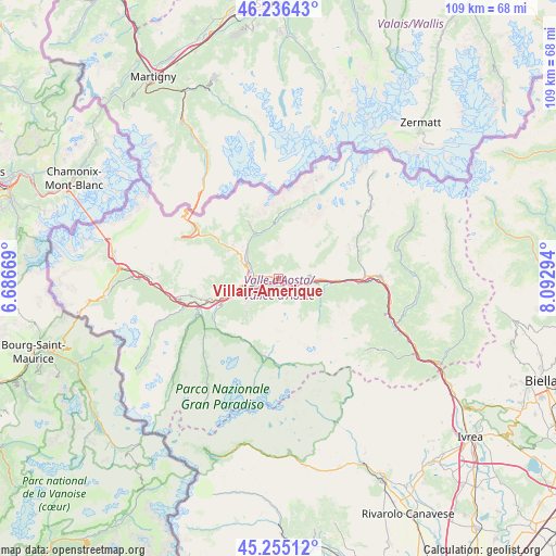
Villair-Amerique GPS coordinates[2]
45° 44' 52.548" North, 7° 23' 23.352" East
| Map corner | latitude | longitude |
|---|---|---|
| Upper-left | 46.23643°, | 6.68669° |
| Center: | 45.74793°, | 7.38982° |
| Lower-right: | 45.25512°, | 8.09294° |
| Map W x H: | 109.1×109.1 km | = 67.8×67.8mi |
| max Lat: | 47.04031° ⇑16.6% North |
| Villair-Amerique: | 45.74793° |
| min Lat: | ⇓83.4% South 35.50142° |
| min Long | Villair-Ameriqu | max Long |
| 6.69888° | 7.38982° | 18.48682° |
| W 1.6%⇐ | ⇒98.4% E |
Elevation
Elevation of Villair-Amerique is 618 m = 2028 ft, and this is 311.3 m = 1021 ft above average elevation for this country.
| Max E: |
2085 m = 6841 ft | 14.8% |
| Villair-Amerique | 618 m 2028 ft | |
| Avg. | 306.7 m = 1006 ft | |
Min E: |
-4 m = -13 ft | 85.2% |
See also: Italy elevation on elevation.city.
Geographical zone
Villair-Amerique is located in North temperate zone (between Tropic of Cancer and the Arctic Circle). Distance of this North polar circle is 2314.5 km =1438.2 mi to North.| Distance of | km | miles | from Villair-Amerique |
|---|---|---|---|
| North Pole | 4920.4 | 3057.4 | to North |
| Arctic Circle | 2314.5 | 1438.2 | to North |
| Tropic Cancer | 2480.8 | 1541.5 | to South |
| Equator | 5086.7 | 3160.7 | to South |


Nearby cities:
15 places around Villair-Amerique: (largest is in red/bold)
• Aosta
5.7 km =3.5 mi,  258°
258°
• Chantignan
1.7 km =1.1 mi,  86°
86°
• Charvensod
5.9 km =3.7 mi,  238°
238°
• Chef-Lieu
2.8 km =1.7 mi,  276°
276°
• Grand Brissogne
2.5 km =1.6 mi,  175°
175°
• Neyran-Etabloz
2.6 km =1.6 mi,  133°
133°
• Nus
6 km =3.7 mi,  98°
98°
• Petit Fenis
5.8 km =3.6 mi, 86°
• Plan Felinaz-Felinaz
4.9 km =3 mi, 242°
• Pollein
3.7 km =2.3 mi,  233°
233°
• Porossan
4.9 km =3 mi, 280°
• Quart
2.1 km =1.3 mi,  111°
111°
• Saint Marcel
4.9 km =3 mi, 112°
• Saint-Christophe
3.4 km =2.1 mi, 281°
• Villefranche
2.2 km =1.4 mi, 111°
Sources, notices
• [Note1] Compared only with cities in Italy existing in our database
• [Src1] Map data: © OpenStreetMap contributors (CC-BY-SA)
• [Src2] Other city data from geonames.org with taken over terms of usage.
• [Src3] Geographical zone / Annual Mean Temperature by Robert A. Rohde @ Wikipedia
