Pozzale-Case Nuove geodata
Pozzale-Case Nuove (Tuscany) is a populated place; located in Italy in Europe/Rome (GMT+2) time zone. With population of 1,665 people, there are 4748 cities with bigger population in this country. Compared to other cities in Italy, 58.2% of cities are located further ↑North; 57.9% of cities are located further →East and 83.7% of cities have higher elevation than Pozzale-Case Nuove. Note1


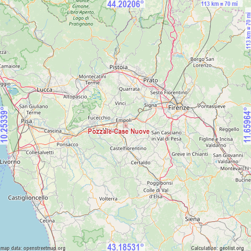
Pozzale-Case Nuove GPS coordinates[2]
43° 41' 45.024" North, 10° 57' 23.436" East
| Map corner | latitude | longitude |
|---|---|---|
| Upper-left | 44.20206°, | 10.25339° |
| Center: | 43.69584°, | 10.95651° |
| Lower-right: | 43.18531°, | 11.65964° |
| Map W x H: | 113.1×113 km | = 70.3×70.2mi |
| max Lat: | 47.04031° ⇑58.2% North |
| Pozzale-Case Nuove: | 43.69584° |
| min Lat: | ⇓41.8% South 35.50142° |
| min Long | Pozzale-Case Nu | max Long |
| 6.69888° | 10.95651° | 18.48682° |
| W 42.1%⇐ | ⇒57.9% E |
Elevation
Elevation of Pozzale-Case Nuove is 35 m = 115 ft, and this is 271.7 m = 891 ft below average elevation for this country.
| Max E: |
2085 m = 6841 ft | 83.7% |
| Avg. | 306.7 m = 1006 ft | |
| Pozzale-Case Nuove | 35 m = 115 ft | |
Min E: |
-4 m = -13 ft | 16.3% |
See also: Italy elevation on elevation.city.
Geographical zone
Pozzale-Case Nuove is located in North temperate zone (between Tropic of Cancer and the Arctic Circle). Distance of this Northern Tropic circle is 2252.6 km =1399.7 mi to South.| Distance of | km | miles | from Pozzale-Case Nuove |
|---|---|---|---|
| North Pole | 5148.5 | 3199.1 | to North |
| Arctic Circle | 2542.7 | 1580 | to North |
| Tropic Cancer | 2252.6 | 1399.7 | to South |
| Equator | 4858.5 | 3018.9 | to South |


Nearby cities:
15 places around Pozzale-Case Nuove: (largest is in red/bold)
• Bassa
7.4 km =4.6 mi,  294°
294°
• Cambiano
7 km =4.3 mi,  177°
177°
• Capraia e Limite
5.9 km =3.7 mi,  21°
21°
• Castelnuovo d'Elsa
6.9 km =4.3 mi,  192°
192°
• Cerreto Guidi
9.2 km =5.7 mi,  319°
319°
• Dogana
8.9 km =5.5 mi, 182°
• Empoli
2.6 km =1.6 mi,  343°
343°
• Isola
6.7 km =4.2 mi, 286°
• Limite
5.7 km =3.5 mi, 19°
• Marcignana
6.3 km =3.9 mi, 293°
• Montelupo Fiorentino
5.7 km =3.5 mi,  48°
48°
• Monterappoli
2.2 km =1.4 mi,  211°
211°
• Ponte A Elsa
5.2 km =3.2 mi,  261°
261°
• San Miniato
8.8 km =5.5 mi, 258°
• Spicchio-Sovigliana
4.1 km =2.5 mi, 339°
Sources, notices
• [Note1] Compared only with cities in Italy existing in our database
• [Src1] Map data: © OpenStreetMap contributors (CC-BY-SA)
• [Src2] Other city data from geonames.org with taken over terms of usage.
• [Src3] Geographical zone / Annual Mean Temperature by Robert A. Rohde @ Wikipedia
