Abbazia geodata
Abbazia (Lombardy) is a populated place; located in Italy in Europe/Rome (GMT+2) time zone. With population of 1,574 people, there are 4952 cities with bigger population in this country. Compared to other cities in Italy, 83.4% of cities are located further ↓South; 69.4% of cities are located further →East and 72.3% of cities have lower elevation than Abbazia. Note1


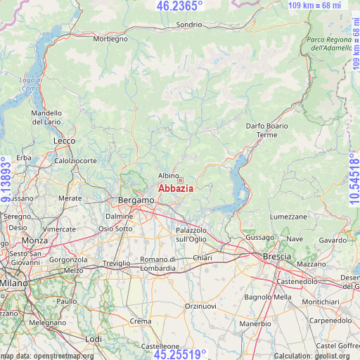
Abbazia GPS coordinates[2]
45° 44' 52.8" North, 9° 50' 31.38" East
| Map corner | latitude | longitude |
|---|---|---|
| Upper-left | 46.2365°, | 9.13893° |
| Center: | 45.748°, | 9.84205° |
| Lower-right: | 45.25519°, | 10.54518° |
| Map W x H: | 109.1×109.1 km | = 67.8×67.8mi |
| max Lat: | 47.04031° ⇑16.6% North |
| Abbazia: | 45.748° |
| min Lat: | ⇓83.4% South 35.50142° |
| min Long | Abbazia | max Long |
| 6.69888° | 9.84205° | 18.48682° |
| W 30.6%⇐ | ⇒69.4% E |
Elevation
Elevation of Abbazia is 418 m = 1371 ft, and this is 111.3 m = 365 ft above average elevation for this country.
| Max E: |
2085 m = 6841 ft | 27.7% |
| Abbazia | 418 m 1371 ft | |
| Avg. | 306.7 m = 1006 ft | |
Min E: |
-4 m = -13 ft | 72.3% |
See also: Italy elevation on elevation.city.
Geographical zone
Abbazia is located in North temperate zone (between Tropic of Cancer and the Arctic Circle). Distance of this North polar circle is 2314.5 km =1438.2 mi to North.| Distance of | km | miles | from Abbazia |
|---|---|---|---|
| North Pole | 4920.4 | 3057.4 | to North |
| Arctic Circle | 2314.5 | 1438.2 | to North |
| Tropic Cancer | 2480.8 | 1541.5 | to South |
| Equator | 5086.7 | 3160.7 | to South |


Nearby cities:
15 places around Abbazia: (largest is in red/bold)
• Albino
3.8 km =2.4 mi,  298°
298°
• Borgo di Terzo
4.9 km =3 mi,  128°
128°
• Casazza
5 km =3.1 mi,  89°
89°
• Casco
4.3 km =2.7 mi,  197°
197°
• Cenate Sopra
4.2 km =2.6 mi, 201°
• Cenate di Sotto
5.6 km =3.5 mi,  192°
192°
• Cene
3.8 km =2.4 mi,  341°
341°
• Entratico
5.1 km =3.2 mi,  151°
151°
• Gaverina Terme
3.6 km =2.2 mi,  75°
75°
• Gazzaniga
5.1 km =3.2 mi,  349°
349°
• Grone
5.7 km =3.5 mi,  114°
114°
• Luzzana
4.7 km =2.9 mi,  140°
140°
• Pradalunga
4.6 km =2.9 mi,  267°
267°
• Vall'Alta
1.9 km =1.2 mi,  320°
320°
• Vigano San Martino
4.9 km =3 mi,  120°
120°
Sources, notices
• [Note1] Compared only with cities in Italy existing in our database
• [Src1] Map data: © OpenStreetMap contributors (CC-BY-SA)
• [Src2] Other city data from geonames.org with taken over terms of usage.
• [Src3] Geographical zone / Annual Mean Temperature by Robert A. Rohde @ Wikipedia
